Gelt Linn Waterfall
Sunday 19th April 2026 | Gelt Linn is a little known waterfall ( or ‘linn’) near Slaggyford, South Tynedale, Northumberland. Getting there involves a relatively straightforward, out-and-back hike – uphill on the way out, downhill coming back, exposed and potentially soggy. Extending it to the Northumberland/Cumbrian boundary (as we did) is significantly more arduous, involving much ‘heather bashing’. Do the second part only if you REALLY want to or if (like us) you’ve got plans further afield!
Stats at a Glance
[Stats to the waterfall]
Distance 13.5 km/8.4 miles [11 km/6.8 miles] | Elevation Gain 408 m/1338 ft [210 m/688 ft] | Maximum Elevation 558 m/1831 ft [420 m/1378 ft] | Going Generally firm with potentially (very) muddy/boggy sections on trail, track, road [arduous, steep, boggy, heather; sporadic, indistinct trail] | Terrain Moorland, farmland, woodland, urban | Exposure Mainly (very) exposed | Navigation Generic way-marking as far as the waterfall; none beyond (OS Explorer OL31; Explorer OL43; Landranger 86 | Hospitality & Supplies Slaggyford Station (Ca*) | Start & Finish Slaggyford Station, South Tynedale Railway, Slaggyford CA8 7NH; NY 675523; W3W:///dragon.spoils.commuted | Grade Challenge | GPS File
On the Trail
Introduction
In his book Northumberland Rocks [ISBN 9781916237674], Ian Jackson describes Gelt Linn as a “fossil waterfall and steep valley, cut when there were melting ice sheets covering all northern England”. Today, the Gelt Burn, which flows over the waterfall, is classified as a ‘misfit’ or ‘underfit’ stream. This means that, in its current state, it couldn’t have created the channel (known as Butt Hill channel) it now occupies. A far greater volumer of water would have been needed, in the amounts issued from under an ice sheet around 10,000 years ago, for instance.
Personally, I can’t resist the pull of a decent waterfall, especially one off the beaten track and hitherto unknown to me. While it would be the main objective, we planned to include it in a longer hike, over the ridge into Cumbria, using a bridleway that would take us towards the village of Croglin in the Eden Valley.
The South Tynedale Railway
This particular waterfall is all the more interesting for its proximity to the South Tynedale Railway. Although we didn’t do it ourselves, it’s possible to take the train from Alston to Slaggyford, hike to the waterfall and back, then return to Alston on the train – a particularly nice day out in the right conditions.
The narrow-gauge railway runs on the track bed of the former Alston Line, constructed by the Newcastle & Carlisle Railway in 1852. Despite being earmarked for closure in the 1960s Beeching cuts the little-used line remained operational until 1976.
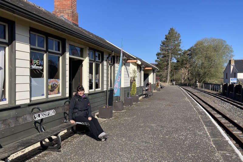
Slaggyford Station, as it survives today, would be a quaint, quiet location if it wasn’t for the noisy willow-warblers. I can’t imagine it being much busier when the train arrives. There’s a cafe in a converted carriage and a kiosk selling ice-cream. I couldn’t say when you’d find them open but both were when we were there.
We started our hike from the car park by the station. You squeeze behind the old signal box and walk the length of the platform, cross the track to a gate onto the South Tyne Trail. This popular walking trail follows the course of the old railway all the way down South Tynedale to Haltwhistle, via the spectacular Lambley Viaduct.
Beyond The South Tyne Trail
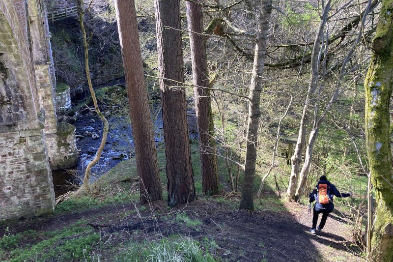
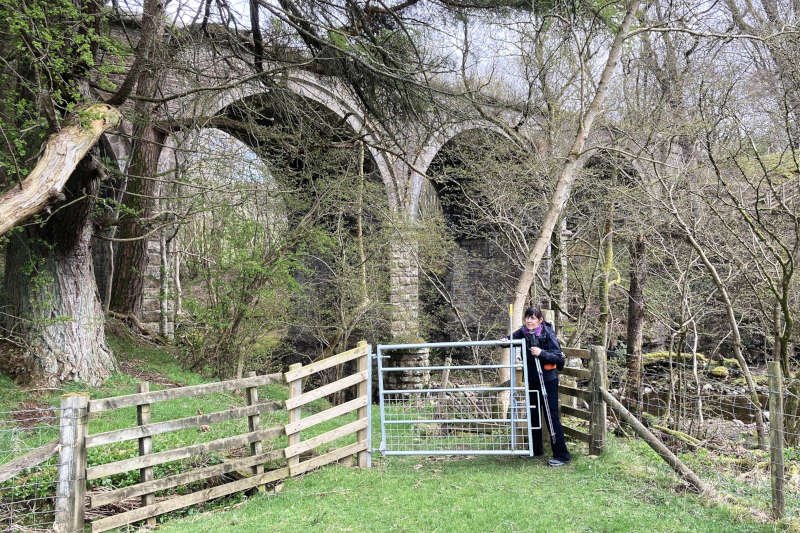
We, however, left the trail almost immediately, after crossing another Grade II-listed but much smaller viaduct over the Knar Burn. The path is easy to miss, being no more than a loose trail. It drops steeply off the embankment to a gate, just above the level of the burn.
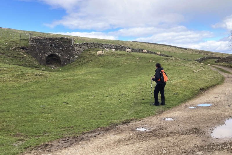
Next, comes a steady climb, through fields studded with curious sheep, many with new-born lambs, to a lane at The Barns. Turning left, we continued on the lane, through the farm at Aules Hill after which the lane (still marked on the map as such) essentially becomes a track.
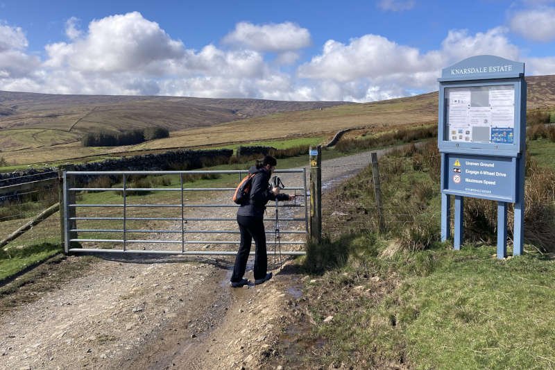
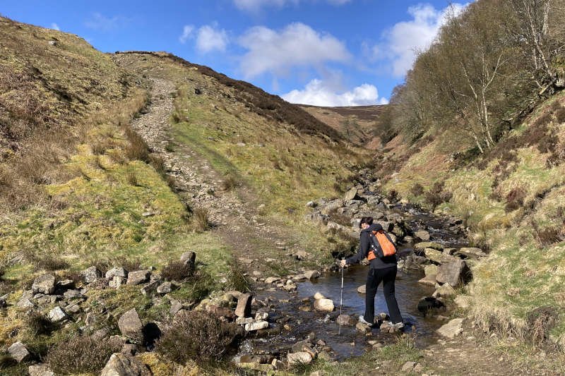
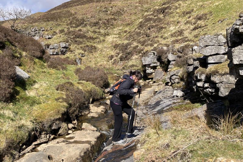
After about a mile – past the farm at Hanging Shaw and having entered the Knarsdale Estate – you cross the Hut Burn via a steep and rocky approach and exit. Don’t worry too much about a possible foot-wetting; there’s plenty of potential for that on the boggy trail around the flank of Knarsdale Common. The waterfall lies about one-and-a-half miles distant.
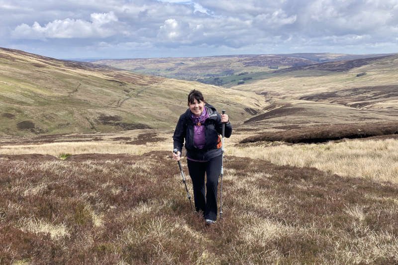
As you might reasonably anticipate, views are fantastic and had been for some time. You’ll know you’ve reached Limestone Hill when you find yourself between a substantial lime kiln, just off the trail, low down to the left, and a small quarry on the right from whence the raw material must have come. From here, it’s about another mile to the waterfall.
Continuing steadily upwards, the trail directs you towards a gate at the corner of two walls – beyond the biggest, boggiest patch of ground encountered so far. In attempting to avoid it we were forced higher, away from the gate, making the approach longer and more arduous than it needed to be. In retrospect I’d have walked straight towards it.
This brings me to the issue of footwear: both of us were wearing approach shoes which, we agreed, might have better been replaced by either boots or trainers. The rugged and boggy terrain made stiff, ankle-height shoes somewhat uncomfortable and easily penetrated by water in the frequent patches of boggy ground.
Where’s The Waterfall?
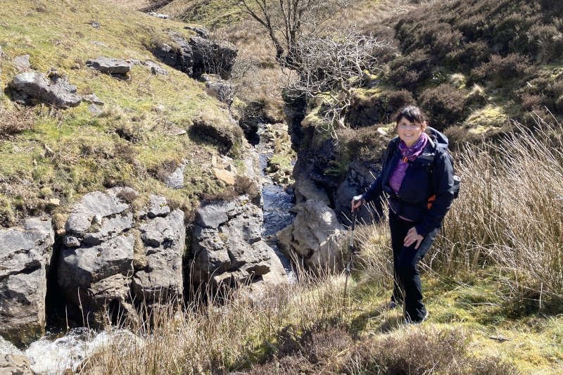
The waterfall lies just beyond the gate but to get to it, you’ll need to descend steeply to the left. However, at the time I wasn’t sure where the trail – marked boldly on the map as a bridleway – went, or how it interacted with the falls, so stuck with it.
Consequently we ended up walking around the top of the waterfall which remained out of sight to the left. When I decided we’d gone too far, we made a steep descent towards the burn. This brought us up close to the slot with a worthwhile view looking down from the top. Determined to visit the base of the falls we made a steep descent on the north side of the burn.
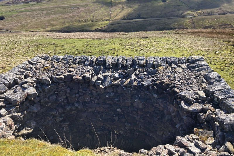
Sitting at an elevation of 400 m Gelt Linn isn’t the biggest, nor is it the most dramatic waterfall in the area but it certainly has character and is well worth the walk. I’d imagine that heavy rain would make it a lot more impressive. The water has cut a narrow slot through a significant exposure of the Great Limestone, the thickest, most exploited limestone member in the North Pennines, laid down during the Carboniferous period, around 300-350 mya.
After taking your fill at the falls, I’d advise turning around and walking back the way you’ve come. There’s little more to see this side of the ridge.
An Uphill Struggle
We however, chose to continue upwards from the base of the falls rather than return to the bridlepath (such as it is). I thought we might intersect it further up what’s shown on the map as Broad Mea. Alas, what we got was a steep, soggy struggle through bog and heather as we made our way towards a line of shooting boxes or ‘grouse butts’.
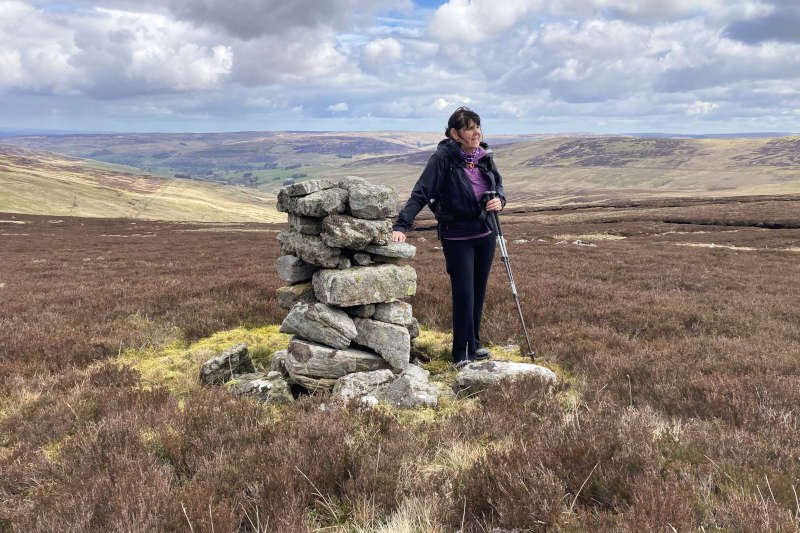
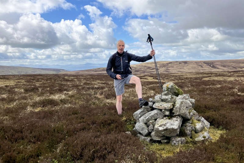
We never found the bridleway. Instead, on reaching the grouse butts, I took advantage of an indistinct but useable trail to continue upwards, towards a currick that lay in the direction of Gillingbrigg Gate, the crossing point on the boundary fence. I was using GPS for navigation as the route is split over two maps.
By now, the gradient had lessened significantly; the going was easier but still involved much heather. When we finally arrived at the fence we were treated to a superb view into the Vale of Eden – as well as a first sight of foreboding clouds heading towards us. From the forecast, I’d thought we’d have missed any rain but, from the look of it, it now seemed unlikely.
The initial idea had been to do an 18-mile circuit across the Pennines, maybe dropping down into Croglin itself, then returning via a different route. With the poor trail making for slow going and the clouds looking the way they were we decided against it, and turned back. Not being convinced of the validity of the bridleway, or that I’d even find it, I opted to go back the way we’d come.
Wet Legs Back At The Falls
It was a decent plan and was working well; we’d reached the grouse butts when the rain finally intercepted us. It quickly became obvious that we were going to get a decent soaking as the wind had whipped up also, so we stopped to don our jackets. It was a good move as, by the time we’d descended to the burn above the waterfall we were both soaked below the waist. When Diane slipped into the burn as she attempted to cross, it barely mattered. She said later, that she expected to see me taking a photograph – sadly, I wasn’t that quick!
Thankfully, with the clouds scattered as they were, the rain stopped almost as quickly as it had begun. Being as wet as we were at least helped ensure that we didn’t feel inclined to pussyfoot around boggy ground. This helped make the downhill journey back to Slaggyford even quicker though, by now, the sun had returned, making conditions about as pleasant as you’d like them to be. By the time we regained the tarmac lane, we were more or less dry, jackets already back in our packs.
Conditions were such that we could take every opportunity to admire the view over South Tynedale as we strolled downhill, back through the sheep-filled fields. Directly ahead is the impressive viaduct, built to span the relatively insignificant Knar Burn. Regaining the South Tyne Trail at the top of the viaduct involves a steep, struggle on a loose trail, using the trees to help pull yourself upwards.
Once back on the trail, it’s a short stroll, over the viaduct, through the gate, across the track and back onto the platform. We were pleasantly surprised to find the cafe still open so sat down for a cuppa – more for the experience than anything else as our car and supplies were less than a hundred metres away.
Conclusion
This is a waterfall definitely worth the walk, but no further (providing you’re not looking for a challenging upland route into the Eden Valley). I’d definitely consider making a day of it by combining it with a trip on the South Tynedale Railway. As I said earlier I’d probably opt to wear boots or trainers (‘trail runners’ as Americans call them) possibly combined with waterproof socks but probably not. Make sure you’re prepared for wet weather as it’s quickly upon you, this close to the Pennine ridge – and take a picnic for your time at the waterfall which is quite sheltered at the base.