Around the Rezzie
Saturday 16th May 2026 | This anticlockwise circuit of the Derwent Reservoir falls into two parts, divided more or less equally between County Durham and Northumberland. The route starts from Millshield Picnic Area on the Northumberland side of the reservoir. While it costs £5 to park all day, it offers the benefit of a well maintained toilet block.
Route map for Around the Rezzie by Durham Cow on plotaroute.com
Stats at a Glance
Distance 26.2 km/16.3 miles | Elevation Gain 437 m/1434 ft | Maximum Elevation 430 m/1411 ft (Buckshott Fell) |Going Generally firm with potentially muddy sections on trail, track, road | Terrain Moorland, farmland, woodland, urban | Exposure Mix of sheltered and very exposed | Navigation Generic way-marking (OS Explorer 307; Explorer OL43; Landranger 87 | Hospitality & Supplies Blanchland (PH; Ca); Edmundbyers (PH; YHA) | Start & Finish Millshield Picnic Area (Derwent Reservoir), Barley Hill DH8 9SB; NZ 013532; W3W:///expired.swept.bookshelf | Grade Challenge | GPS File
On the Trail
I’d decided to use my Garmin GPS for navigation as I did for last week’s route in Weardale. Both routes fall across two maps which makes it a bit awkward. Like last week, I didn’t feel the need to load the route onto the device.
The weather was forecast to be cool and calm, with broken cloud and no rain until the evening by which time we hoped to be finished. Perfect walking conditions unless you actually enjoy sweating.
There wouldn’t be quite so much ascent this time though the elevation was still considerable. To maintain a degree of challenge I’d sought permission to increase the mileage to what, in the end, turned out to be a neat 17 miles.
Millshield to Slaley Forest
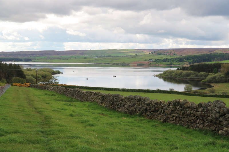
On leaving the picnic area, using the same route by which we’d arrived, there’s a short ascent to reach the road that skirts the Northumberland side of the reservoir – known as School Lane.
After turning left, downhill, there’s just under half-a-mile to walk on the road to reach a grassy, restricted byway, marked by a roadside fingerpost. Although it’s marked clearly on Plotaroute’s OS map overlay, for some strange reason it’s missing on the actual OS map.
Over the next mile, the trail ascends 200 ft across farmland to reach the lane at Esper Shields. A skylark and lapwing flew above and around us noisily while a red kite soared silently doing its own thing. On reaching the lane we observed that this un-mapped but otherwise well-indicated byway is an extension of the Coal Road that continues NW in the direction of Slaley Hall.
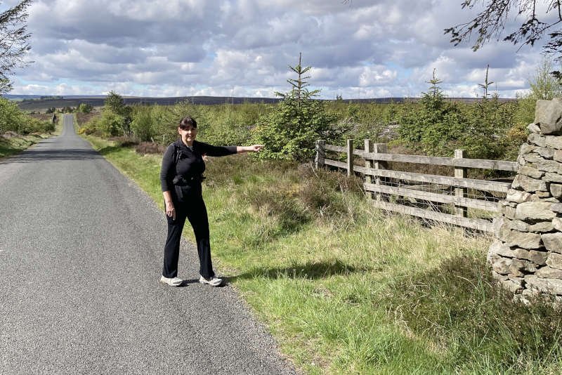
After just under another mile on the lane – a boundary line for the North Pennines National Landscape – we turned right onto an unrestricted byway or rather, we should have. The route on the GPS seemed to indicate that access was via a track a few metres further on, following the line of the wall. My misjudgement resulted in about 250 m of unnecessary slogging over piles of dead trees and trying in vain to dodge between very spiky, young sitka spruce.
Wisely, Diane kept her opinions of the route choice to herself. Once we’d regained the track, and were able to make decent progress again, I spent a good ten minutes trying to justify myself. I think it fell on deaf ears though. Almost as soon as I’d stopped talking we arrived at our first encounter with the B6306 (3 miles) and crossed into Slaley Forest.
Slaley Forest to Blanchland
The gently undulating trail through the forest emerges onto Blanchland Moor at Actoncleugh Head (4.5 miles). Here we joined the 211-mile long-distance trail known – I think somewhat clunkily – as ‘A Pennine Journey’. It was popularised by Alfred Wainwright in his 1986 book, A Pennine Journey: The Story of a Long Walk in 1938 and would take us to just beyond the outskirts of Blanchland.
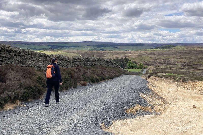
The trail climbs over the moor, past Warlaw Pike, onto the exposed ridge separating Bulbeck Common from Blanchland Moor. For the first mile or so the previously muddy path has been consolidated with heavy ballast which ends approaching the brow of the ridge. The stones are loose and harsh and the sandy trail, to which they give way, offers a more amenable surface for walking. I might offer a different opinion after wet weather however.
On the other side of the ridge there’s a steep descent – where the ballasted track begins again – to the Shildon Burn at Pennypie House (6.5 miles).
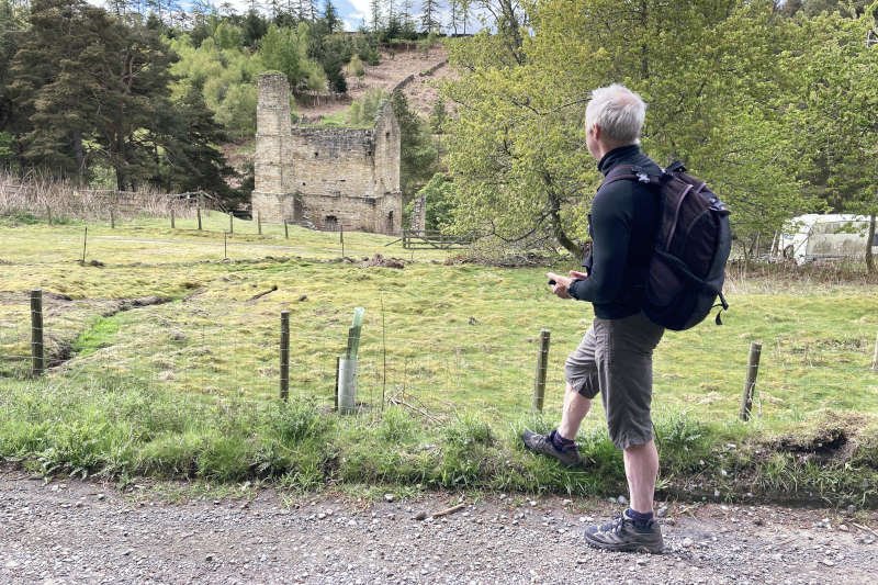
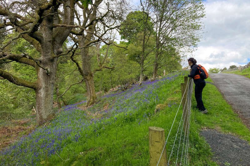
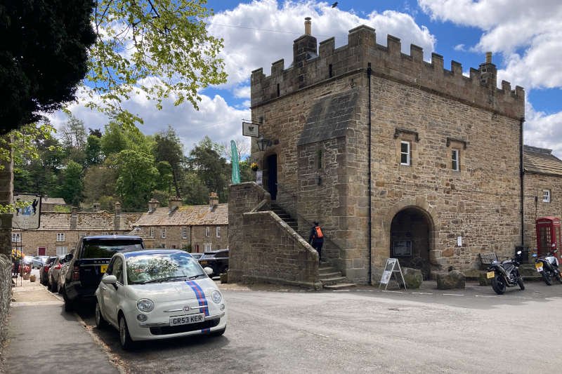
Following the lane alongside the burn eventually brings you to Shildon Engine House, at just over 7 miles. Also known (briefly) as Shildon Castle its purpose has never been in doubt but it certainly projects an air of something beyond the industrial. I’d recommend taking time to explore – it doesn’t take long. Commissioned to pump water in 1808 it sits in a steep gully carved out by the Shildon Burn the banks of which, at this time of year, are carpeted with bluebells.
Blanchland to Buckshott Fell
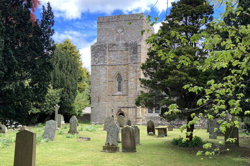
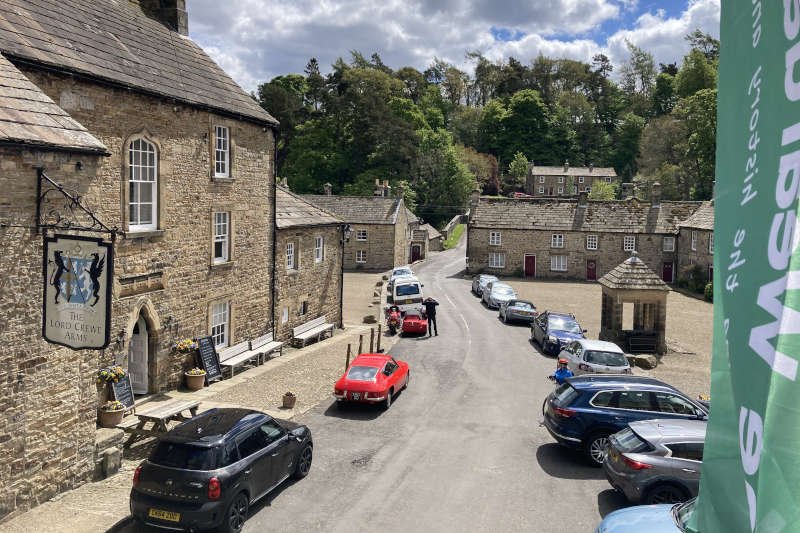
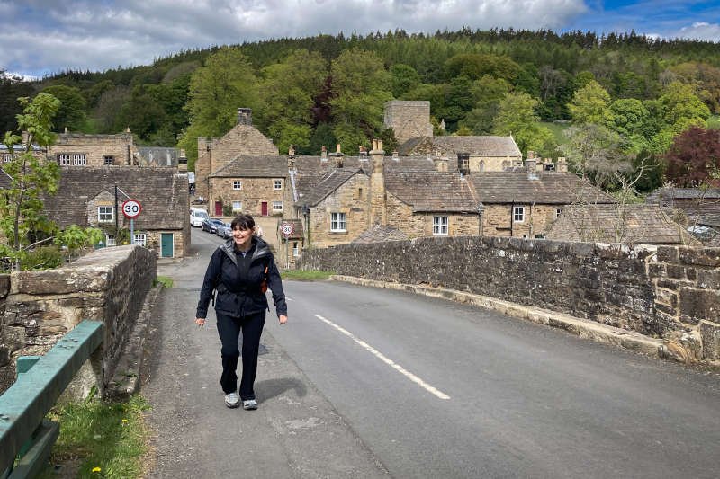
Beyond the engine house, half a mile further along the lane, you finally arrive in Blanchland which, I’m sure, can claim to be one of the UK’s most charismatic villages. First, you’ll pass the White Monk tearoom (originally a school), followed by the c12th Premonstratensian abbey church with its distinctive gatehouse opposite and just beyond that, the Lord Crewe Arms hotel. The hotel was once the abbot’s lodgings before it became the manor house. The picturesque quadrangle through which the B6306 passes was once housing for lead miners and then extremely dilapidated.
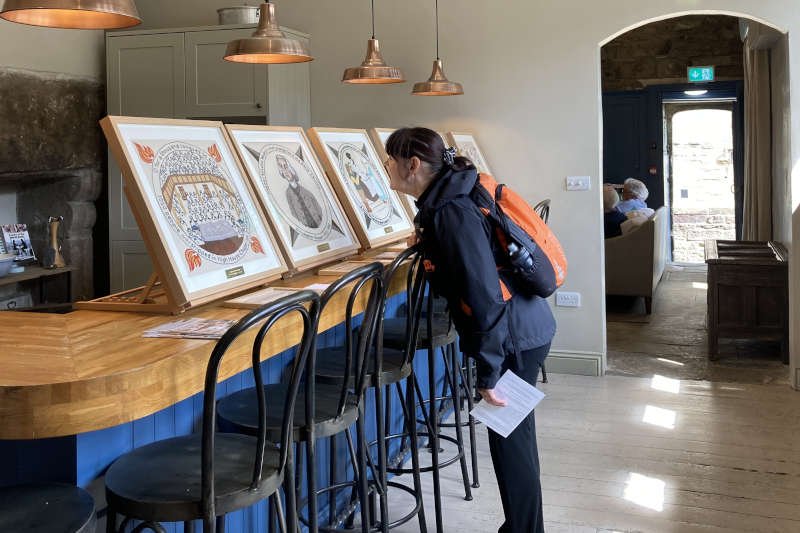
We’d planned that Blanchland would be our first hospitality stop and headed straight for the Lord Crewe Arms. In the gatehouse the Weardale Museum (visited easily from the Weardale Way) was exhibiting a collection of contemporary tapestries, all with a Methodist theme – we made a note to pop in before we left.
Conditions were just about mild enough to make the enclosed beer garden a comfortable option where I had a half-pint of the Twice Brewed brewery’s ‘Crewe Brew’ pale ale and Diane, her usual cider. After leaving the pub, we headed next door to visit the church (always recommended) then crossed the road to the tapestry exhibition in the gatehouse. Here we were offered sticky dots with which to indicate our favourite pieces. One of mine went to an ‘Isaac’s Tea Trail’ themed tapestry – they were all good though.
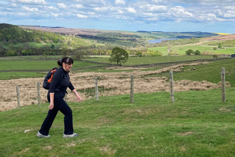
The biggest ascent of the day begins at the foot of c18th Blanchland Bridge which crosses the River Derwent on the outskirts of the village, the County Durham/Northumberland boundary. It’s where the ‘A Pennine Journey’ trail also takes its leave. Ahead lies a mile-and-a-half long ascent – via road and bridleway – to the ridge on Buckshott Fell which, at 420 m, is the highest point on the route.
It’s a constant gradient towards Allenshields – long and straight – becoming much steeper once you reach the bridleway that takes you over Buckshott Fell. Take your time and check out views over Derwentdale, towards the reservoir. Our own ascent was accompanied most of the way by the loud calls of a persistent cuckoo that remained frustratingly unseen.
Buckshott Fell to Edmundbyers
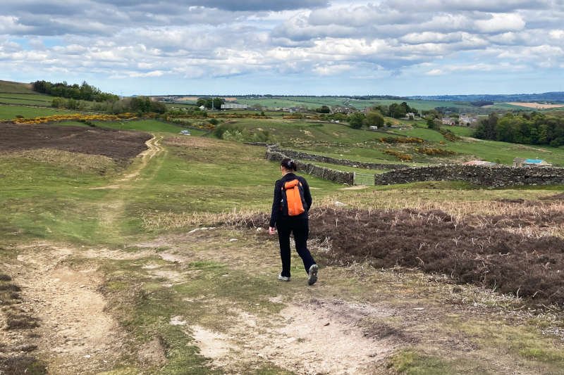
On cresting the ridge at just over 9 miles, it’s time to turn east, on another bridleway, for a 3.5 mile, undulating descent – rocky in places – over Edmondbyers Common towards the village of Edmundbyers (different spellings).
The route passes above a farmhouse – on the site of a medieval settlement – at Pedam’s Oak. The unusual name is believed to derive from the fact that, at some undisclosed time in the past, a horse thief called Pedam escaped his pursuers by hiding in the now felled oak.
Apart from the bluebells, another natural characteristic at this time of year, is the pleasant coconut-like smell of the gorse, abundant around the route and particularly after crossing the Black Burn near Edmundbyers, approaching the 13-mile mark.
Edmundbyers to Derwent Reservoir (Dam)
Edmundbyers, as its name seems to suggest, is an ancient settlement, possibly dating to the Bronze Age and certainly established by the c11th. The church, which is dedicated to St Edmund, was built around 1100 AD but may stand on an Anglo-Saxon site. Along with many villages in County Durham, Edmundbyers is duly recorded in the c12th Boldon Book, the local equivalent of the Domesday Book.
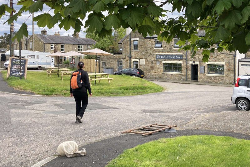
Today the village lies on a popular tourist route and, thankfully for us, boasts a couple of pubs. We opted for The Derwent Arms where we ordered hot drinks before the alcoholic ones. The landlord in The Derwent Arms was newly arrived and very hospitable. It was all very pleasant and harder to get the legs to lift me out of a comfy chair than I’d have wished.
On the way out of the village we passed ‘The Baa’, the second pub in the village, attached to the YHA. Formally known as Low House, it dates to around 1600 and was once a coaching inn. It has served as the home for a local MP, as the Miners Arms inn, and as a tearoom and shop before opening, in 1933, as a 40-bed hostel. As intriguing as it sounds it would have been no good to us as it doesn’t open until 4 pm.
It’s only a mile from the village to the Derwent Reservoir’s dam wall. Unfortunately, over half of that distance is on the B6278, a popular, fast-moving route between the A68 and Weardale. Being winding, relatively narrow and with no footpath means that it can be a bit stressful for walkers; it was a relief to reach the reservoir access road after about three-quarters of a mile.
On the way, we noticed some relatively unusual cattle, for these parts anyway. We thought they might have been English Longhorn even though none had horns of any length whatsoever. They looked quite young though.
Derwent Reservoir (Dam) to Millshield
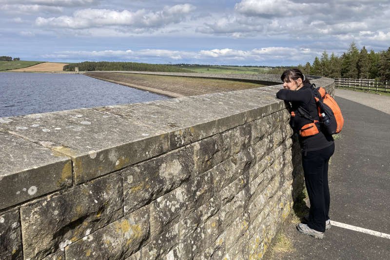
With the busy main road behind us, the access road conducted us, quietly and directly, to the SW end of the dam where we found preparations being made for the Derwent Reservoir Duathlon (10 km/40 km/5 km). This was to be held the next day and got me thinking that I might give it a go sometime.
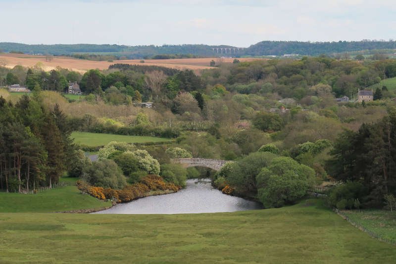
Crossing the dam, the view towards the SE overlooks the ouflowing River Derwent. The single-arch bridge in the foreground is Derwent Bridge (aka Ratchwood Bridge), built in 1829, Grade II-listed and fully – though only just – inside Northumberland. In the far distance is the impressive 700 ft long/170 ft high Hownsgill Viaduct built in 1857 and also Grade II-listed.
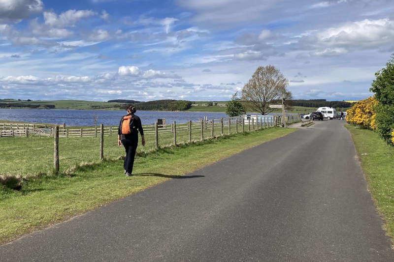
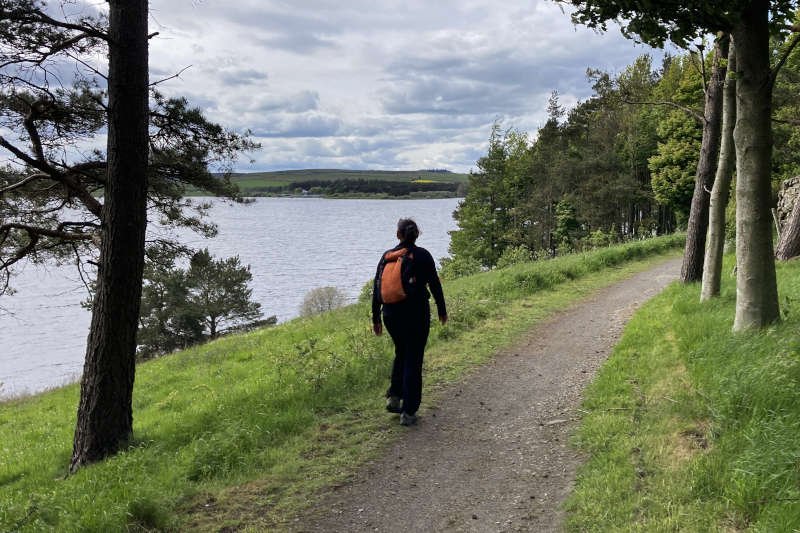
From the other end of the dam – an administrative locality known as Shotley Low Quarter – it’s an easy couple of miles back to Millshield Picnic Area. The route follows a gentle, multi-user trail (where Diane’s inner child felt compelled to have a go on a play-digger) around the edge of the reservoir. Features of interest as far as we were concerned were more cattle in the shape of familiar Belted Galloways (‘Belties’) of the black, and red, varieties. More predictably however, there’s a pleasant lakeside tract of woodland at Cronkley Bank just before the finish.
Conclusion
The fact that I’ve graded this walk as a ‘challenge’ is largely due to the second of its big ascents being quite long, and quite steep in places. There’s also the overall distance and the fact that it’s very exposed for several miles. On a good day – as it was for us – all was relaxed and we had no issues whatsoever. Wind, rain and cold would have made for a very different story.
Walking the route anticlockwise puts hospitality options towards the latter half – where I think most would prefer them. As a bail-out, there’s a good footpath from Blanchland along the Derwent, to the end of the reservoir from where you can take a relatively quite road back to Millshield. This knocks a few miles off and removes the biggest ascent.
As far as we’re concerned this route has got a good balance of everything we look for: distance; gradient; elevation; terrain; views and features. I wouldn’t bother writing about it if I couldn’t recommend it.