




Bowes & Tan Hill
Sunday 19th July 2026 | I planned this walk for a couple of reasons: firstly because I’d never walked or cycled between Bowes and Tan Hill; secondly, because it offers a fairly consistent, relatively shallow profile – useful if you’re looking to introduce elevation into your hikes.
Given that the moosus had struggled a bit last time out, I thought it might be an idea to reduce the degree of ascent and see how she got on. Weather was good, as it had been for weeks; in fact, it was rather on the warm side, making it less easy to manage but ridiculously nice all the same.
Apart from the qualities of the route itself, the two destinations – Bowes and Tan Hill – offer their own unique features. Together with nearby Barnard Castle, Bowes is strongly associated with the author Charles Dickens who conducted research for his novel, Nicholas Nickleby, in the area. Dotheboys Hall, the infamous school in the novel, was modelled on one in the village. Dickens actually stayed at the 400-year-old Ancient Unicorn Hotel during its days as a coaching inn.
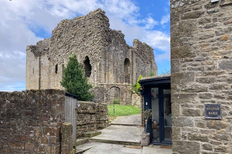
The village also possesses an enigmatic Norman keep built circa 1170 – during the reign of Henry II – which stands on the site of the Roman fort of Lavatrae (or Lavatris). Tan Hill, as most people around these parts will probably know, offers absolutely nothing more than a warm welcome at England’s highest pub.
The circuit is based entirely on the Pennine Way/Pennine Journey walking trails on the way out (and partly on the way back) as well as the NCN 70 cycle route. Alfred Wainwright, famous for his Lakeland guidebooks, was instrumental in establishing both trails. Having recently finished his book A Pennine Journey, I was keen to add this bit of the trail to the various miles I’ve covered to date.
Play the interactive map on Plotaroute by clicking on the arrow below
GPS and other file formats can be downloaded direct from our Plotaroute account where many other routes are also available
Stats at a Glance
Distance 27.7 km/17.2 miles | Elevation Gain 428 m/1404 ft | Maximum Elevation 531 m/1742 ft (Clay Hill) | Profile Undulating; ascent out/descent back | Terrain Moorland; farmland; urban | Going Mostly firm (when dry). Potentially muddy and (very) boggy in places on trail, track and road | Exposure Very exposed for much of the way. Few opportunities for shelter | Navigation & Waymarking Mostly distinct; indistinct in places; Pennine Way; NCN 70; generic signage | Maps & GPS OS Explorer OL30; Landranger 92; GPS FILE | Hospitality & Services Bowes (Acc; Bus; CPf; CS; PH); Tan Hill (Acc; CPf; CS; PH) | Start & Finish Bowes, Co. Durham DL12 9HU; NY995134; W3W:///chuckling.history.encroach | Grade Moderate
Stats-at-a-Glance Definitions (PDF)
Stats-at-a-Glance Abbreviations (an asterisk * indicates special, inconsistent or seasonal hours where known): Acc (Accommodation options); All (all or most of the facilities listed – large towns typically); BC (Bike Centre); Bus (Bus services – remote locations typically); Ca (Cafe/Tearoom); CPp (Car Parking – pay); CPf (Car Parking – free); CS (Camp Site – tents); GS (General Store – varying sizes); PH (Public House/Inn); Rf (Refreshments – mobile or kiosk); RS (Railway Station); WC (Public Toilet); YHA (Hostel)
More photos may be available on the Plotaroute map
Bowes to East Mellwaters (3.5 km/2.2 miles)
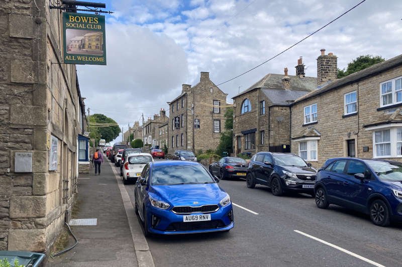
Sometime around 9 am we pulled into a shallow lay-by on the outskirts of Bowes. A few minutes later we were standing half-way up its main street – called ‘The Street’ – alongside its second-most venerable building, The Ancient Unicorn hotel. Not a soul was around to disturb us.
Joining The Street on the left is Back Lane which squeezes between St Giles’ Church (where the headmaster of the school Dickens characterised as Dotheboys Hall is buried) and Bowes Castle. A gate waymarked ‘Pennine Way’ gave access to the trail that would take us all the way to Tan Hill eight miles distant. Passing the austere bulk of the keep it shouldn’t be forgotten that the Roman fort beneath its fields had been deserted for over 600 years before the castle itself was built.
Beyond the castle lies Ivy Hall Farm campsite after which, via a couple of rugged stiles, you reach a lane. This takes you past the farm at Swinholme to the first of three footbridges, this one spanning the River Greta. From here the trail continues to a track stretching between Lady Myres and West Charity Farm.
Rounding the latter you come to Cardwell Bridge, second bridge of the day and the first of two over Sleightholme Beck (I don’t know why footbridges – or bridges in general – seem so important to me but for some reason they always have been). Don’t forget to notice the quiet charm of Sleightholme Beck while crossing the bridge.
Eventually you reach a lane adjacent to another bridge over the River Greta. As attractive as it undoubtedly is, it’s to be ignored. Instead, turn left where you’ll be offered a couple of route choices. We chose to turn right on a trail that was so well signed it simply persuaded us to follow it. The Pennine Way however, continues straight ahead, through the farm at East Mellwaters.
On reflection, the trail we took would have been ideal had we been intending to visit ‘God’s Bridge’. This is a popular feature and natural bridging point on the River Greta where the river has tunneled through the limestone. There’s little to choose between them in terms of distance however so I’ve offered both options on the GPS file.
East Mellwaters to Tan Hill (10.3 km/6.4 miles)
Beyond East Mellwaters is where the ascending starts, at the foot of Wytham Moor. It’s a bit of a shock after such a gentle introduction but it gets easier (well, the gradient does at least). To the left, the moor falls away into ‘The Trough’ created by a more powerful watercourse than Sleightholme Beck appears to be today. Continuing upwards, the route follows the wall around the edge of the moor to Trough Heads.
Here you’ll find a lone finger-post pointing northwards across the moor, somewhat confusingly indicating the Pennine Way and ‘God’s Bridge’. Going by what I’ve said already it can probably be deduced that you could include ‘God’s Bridge’ in the route if you wanted. The direction indicated by the finger-post is the most direct northerly route for the Pennine Way as it’s the Pennine Journey trail that goes uniquely to Bowes.
Anyway, ignore the finger-post and continue alongside the wall until you reach a gate. Through the gate, bear left on the trail descending eventually to another footbridge (Intake Bridge), the second and final bridge over the Sleightholme Beck, at the depressingly named Bog Scar. Continue to the road, past Sleightholme Farm, then to a gate onto Sleightholme Moor where the road becomes a track (Sleightholme Moor Road).
The next four miles to Tan Hill Inn is pretty straight forward, if potentially much wetter, following the Sleightholme Beck and its tributary, the Frumming Beck. After about a mile, the track sweeps left (along which you’ll be returning later). Continue instead to follow the beck, descending shortly afterwards to cross the aforementioned Frumming Beck via a footbridge.
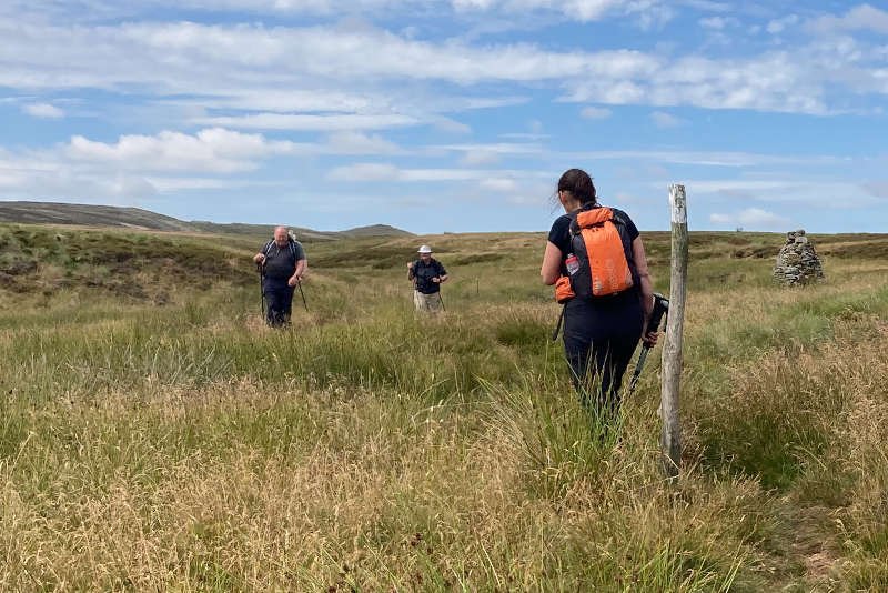
Bear left on the other side, swapping the track for what is likely to be a soggy trail (though after the good weather we’d been enjoying it was quite dry). Look out for cairns where the trail becomes indistinct, bog-dodging as necessary – all the way to the pub. The gradient is constantly upwards but very shallow. A lack of hills often means a lack of features however, so a GPS file (or a good old-fashioned compass bearing) will be particularly handy if visibility is poor.
Tan Hill to Bowes (13.8 km/8.6 miles)
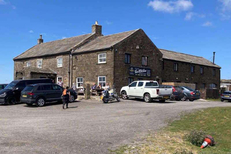
Despite its elevation, or maybe because of it, the Tan Hill Inn is a popular venue for travellers of all kinds: motorists, motorcyclists, cyclists and walkers. I’ve always found it to be welcoming watering-hole whatever the weather (it also offers a FREE camp site).
For the return journey you could, of course, use the same route. We however (well, it was me really) chose to use Sleightholme Moor Road, a vehicle track used by the NCN 70 cycle route. I’d neither walked nor cycled it so was keen to give it a go.
Getting there would normally require a couple of miles on what can be quite a busy moorland road. Linking Swaledale with Brough and the A66 it also functions as part of the boundary between County Durham and North Yorkshire. Works at nearby Mirk Fell Bridge had caused its closure with no means of by-passing locally. Happily for us, the result was an unexpectedly traffic-free trip.
The track itself – to the point where we’d left it on the way out – is about 1.5 miles of shallow downhill gradient on loose ballast. Nothing to write home about as a walker but in the warm, sunny conditions we were blessed with, it offered easy going with long, distracting views.
Once we were back on familiar territory we took the decision – for research purposes – to continue on the road past Sleightholme Farm, heading for a bridleway 1.5 miles distant. Almost all downhill it’s effectively a dead end to normal traffic making it as quiet as anything we’d encountered so far. On that note, we passed a guy carrying a large skateboard, walking back up the hill which, I’m assuming, he’d just skated down (wish I’d asked him).
The bridleway we were looking for is quite close to a waterfall known as Huggill Force. At the time I hadn’t noticed it on the map, but having since done the research, I’m disappointed that we missed it. You might like to include it but at least it’s given me an idea for another outing.
Nevertheless, after swapping tarmac for trail, the stroll downhill through fields warmed by the afternoon sun, was very pleasant indeed. To our front we had an uninterrupted panorama in the direction of Bowes with the castle looking like a dirty sugar cube. In his diary A Pennine Journey, written in 1938, the year before WWII began, Alfred Wainwright wrote that he was told by a rascally farmer that the castle was an air-raid shelter!
On reaching the lane beyond the last field, we turned left towards Lady Myres to pick up, once again, the outward route that took us back over the River Greta to Bowes. The plan had been to conclude our walk with a drink in The Ancient Unicorn. We were crestfallen to find it closed however and have since learned that it’s been that way since 2025. Hopefully that might change but we live in challenging times.
Conclusion
We were fortunate to do this fairly easy-going walk in the nicest of weather with superb visibility (if it’s claggy you’re not going to see much across the moor to Tan Hill). Whatever happens, the pub offers a great objective. We were able to sit outside enjoying the summer sunshine but there’s usually a nice fire going if the weather’s less clement.
I was disappointed to have missed out on Huggill Force and would probably have chosen the route option through East Mellwaters. Definitely a route to be recommended for most walkers though, particularly in decent conditions. As for Diane’s fitness, she was back on top form, unsurprisingly first to the pub at the top of the course!