




Lambley & The Wall
Sunday 2nd August 2026 | I’d come up with this feature-packed hike as a (hopefully) comfortable means of increasing the challenge of terrain and distance. Having noticed its possibilities several months earlier I’d been waiting for the stars to align, so to speak. Given the long spell of dry weather we’ve enjoyed this summer, cooler conditions would be optimum for a route so exposed.
Its principal advantage is that it splits neatly into three sections of about 6 miles each with decent hospitality options at each stop – Greenhead and Haltwhistle. Walking clockwise means that the most challenging terrain and gradients come in the first half of the route.
It’s almost entirely on way-marked trails some of which are National Trails. The short section that isn’t way-marked on the ground is marked on the map as the Pennine Journey trail. I decided to start and finish at a quiet (free) car park off the A689 above Lambley so that Haltwhistle could be used as a hospitality stop. However, Haltwhistle would also work well as a ‘non-driving’ start/finish given its bus and rail links.
In addition to Hadrian’s Wall and the fortifications associated with it, there are many sites along this route sharing the theme of conflict: three medieval castles (plus a fourth, a little further off the route), several buildings incorporating medieval bastle or strong house features and a WWII prisoner-of-war camp. Elsewhere are the sites of abandoned industries together with the disused transport links that serviced them.
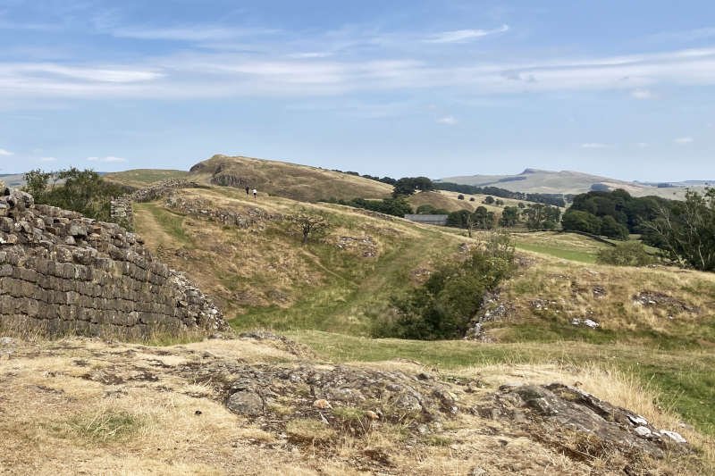
The dominant geological feature is the Whin Sill. Iconic exposures of this volcanic intrusion stretch diagonally across the North East from Teesdale to Dunstanburgh on the North Sea coast. In our case, it underpins a particularly lumpy section of Hadrian’s Wall known as the ‘Nine Nicks of Thirlwall’ extending from Walltown Quarry to Milecastle 44 at Allolee.
Play the interactive map on Plotaroute by clicking on the arrow below
GPS and other file formats can be downloaded direct from our Plotaroute account where many other routes are also available
Stats at a Glance
Distance 28.7 km/17.8 miles | Elevation Gain 575 m/1186 ft | Maximum Elevation 285 m/935 ft (Blenkinsopp Common) | Profile Very undulating before Haltwhistle; mostly flat afterwards | Terrain Moorland; farmland; urban; woodland | Going Mostly firm (when dry); potentially (very) muddy & (very) boggy in places on trail, road, track, upland pavement, duckboards | Exposure Mostly (very) exposed before Haltwhistle | Navigation & Waymarking Mostly distinct; indistinct/indiscernible in places; Pennine Way; Hadrian’s Wall Path; River Tyne Trail (South Tyne Trail); generic | Maps & GPS OS Explorer OL43; Landranger 86); GPS FILE | Hospitality & Services Greenhead (Acc; Bus; Ca; PH); Haltwhistle (All) | Start & Finish CP on A689 at Lambley, Northumberland CA8 7LH; NY671584; W3W:///stored.insulated.amber | Grade Challenge
Stats-at-a-Glance Definitions (PDF)
Stats-at-a-Glance Abbreviations (an asterisk * indicates special, inconsistent or seasonal hours where known): Acc (Accommodation options); All (all or most of the facilities listed – large towns typically); BC (Bike Centre); Bus (Bus services – remote locations typically); Ca (Cafe/Tearoom); CPp (Car Parking – pay); CPf (Car Parking – free); CS (Camp Site – tents); GS (General Store – varying sizes); PH (Public House/Inn); Rf (Refreshments – mobile or kiosk); RS (Railway Station); WC (Public Toilet); YHA (Hostel)
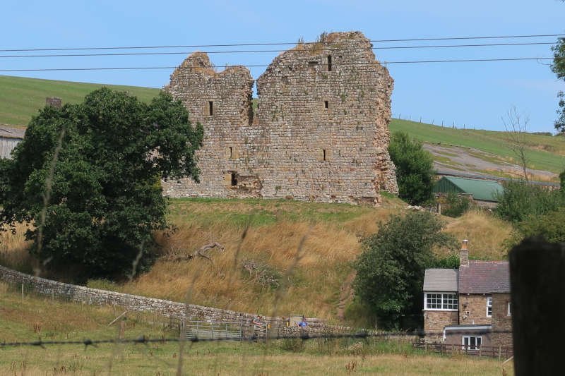
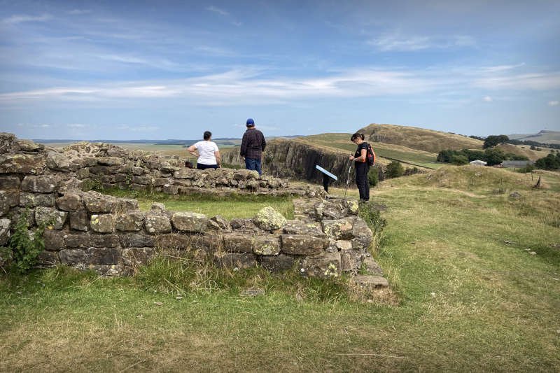
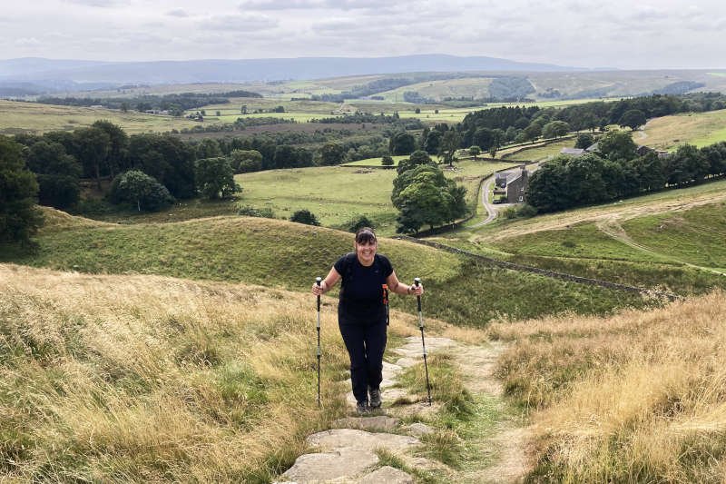
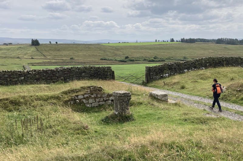
More photos may be available on the Plotaroute map.
Lambley to Greenhead (10.5 km/6.5 miles)
The first of the historic sites on this feature-packed route is our preferred starting location. The quiet car park on the A689 outside Lambley lies directly on the eastern boundary of a significant Romano-British homestead. I didn’t take the time to inspect it myself but it’s marked on the map and fully documented in the online historic record.
Until the 1960s Lambley had been known as Harpertown, a name that seems to have dissolved slowly rather than having been substituted formally. Much longer ago, in the c12th, a small convent of Benedictine nuns had been founded close to the site of what is now Lambley Farm of which the farmhouse itself is part bastle.
There are several ways to start the walk with us choosing what looks like the most direct. Turning left out of the car park we followed the A689, for a half-mile or so, during which time we crossed the course of another significant trail – the Maiden Way. Around 20 miles long, this former Roman supply road crossed the Pennines between forts at Kirby Thore (Bravoniacum), Whitley Castle (Epiacum) and Carvoran (Magnis) on Hadrian’s Wall.
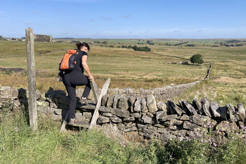
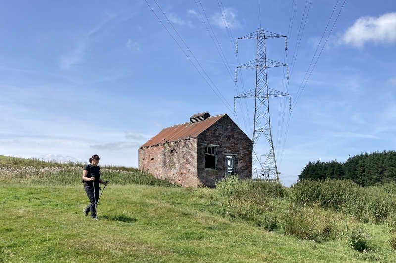
These days, not far away, a Pennine Way finger-post points off the road to the right – towards an A-frame stile leading onto the moor. Just beyond the wall is the track bed of what was generally referred to as the Brampton Railway or, locally, as ‘Lord Carlisle’s Line’. It served the former Lambley Colliery of which some buildings can still be seen. One of several collieries working the small Midgeholme coalfield, it opened in 1846. Like many it suffered mixed fortunes and closed for good in 1958.
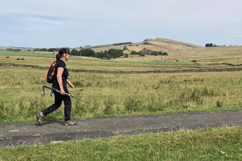
Walking over the moor looks like it could be fickle: despite helpful sections of upland pavement, it would be reasonable to assume that the terrain could get a great deal boggier than it was for us. Beyond High House there’s a steep descent to a footbridge over the Hartley Burn followed by an even steeper ascent at Foxhole Cleugh (FYI a ‘cleugh’ is a steep-sided valley or ravine unlike a ‘heugh’ which is a steep crag).
Beyond the next ridge – after 2 miles – there’s a farm at Ulpham where we passed a fascinating half-hour talking to the farmer mainly about how things were on the fell in his father’s day. Departing the farm, you descend on the trail, across fields, to the Kellah Burn then back uphill on a track to and through another property at Greenriggs.
The trail over Hartleyburn Common, beyond Greenriggs, is somewhat indistinct. We found ourselves slightly off the route here but still heading in the general direction. Nevertheless, I felt the need to correct it and find the actual trail in terrain that, even in good conditions, is fairly featureless. Again it looks like, in wet weather, it could get very boggy indeed and, if visibility is poor, some sort of navigational aid might prove helpful.
Between the next two ridges, there’s an extensive section of marsh where the Glencun Burn rises – with a handy footbridge to cross the burn itself. Beyond that – at around the 4-mile mark – comes a steady ascent onto Blenkinsopp Common, the highest point on the route. In decent visibility you’ll get a distant panorama of the section of the day’s route after Greenhead – the bit along Hadrian’s Wall.
Off the reverse side of Blenkinsopp Common you’ll have plenty of time to contemplate the Tyne Gap below you, with the busy A69 Newcastle-to-Carlisle road running through it. A short distance to the right of the trail, at the point where you cross the wall, is Reay Crag. This natural feature lends its name to a rather obscure colliery, the site of which is a bit further down the hill. The only visible structure that might have been associated with it appears to be a building known as Gap Shields Fan. Whether it ever had a fan inside it – for mine ventilation perhaps – I can’t say.
The route continues to descend to a track on which you turn right. It may have been the bed for a railway that serviced quarries, clay pits and colliery shafts; whatever it was, you follow it to the end. At this point the Pennine Way departs downhill to the left on the more inviting track.
The Pennine Journey trail, which this route follows, isn’t way-marked and crosses the fence via a small stile nearby. An indistinct, sometimes indiscernible trail leads downhill across a rugged field full of reeds, tussocks and thistles. This is where the GPS file will come in handy. It should be accurate enough to deliver you within sight of a gate from where steps lead down through a narrow wood to the edge of the A69. The road is fast and busy but can be crossed safely with patience.
On the other side of the road I made a mistake identifying the trail and ended up back on the roadside. Rather than retrace our steps we decided to continue left at the junction and walk into Greenhead as if we’d been driving. In retrospect I’d advise following the generic way-mark – just off the roadside – to a large gate into a nearby field. From here the trail appears to head diagonally downhill, across fields, into Greenhead.
Greenhead to Haltwhistle (8.9 km/5.5 miles)
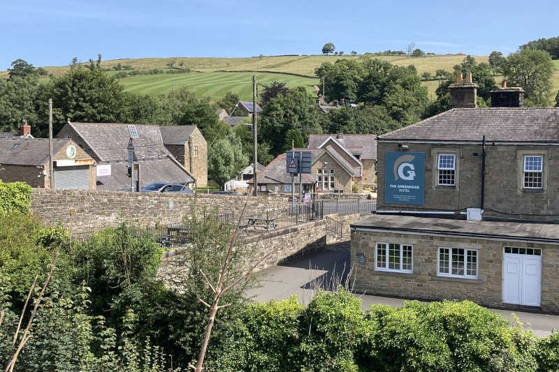
We’d planned to stop for a beer at The Greenhead Hotel but found that it seemed geared more towards dining. To avoid awkwardness we took our drinks outside, sitting on some nearby steps, having failed to notice the seating at the top of them! There’s also a popular tearoom across the road but it’s closed on Sundays.
Leaving Greenhead past the tearoom and hostel there are a couple of route options either side of the Tipalt Burn. We chose to continue alongside the Newcastle-Carlisle railway as far as the crossing where the Pennine Journey, Pennine Way and Hadrian’s Wall Path merge. From this point until Great Chesters you’re following the National Trails’ acorn motif.
As soon as you turn away from the railway the most immediate feature is likely to be the hillside ruins of c14th Thirlwall Castle. We know it well so gave it a miss this time but I’d recommend taking time to have a look given how close it is to the trail.
The castle overlooks the Tipalt Burn where a picturesque footbridge offers a drier alternative to the ford. After a short ascent through woodland, a gate leads to the foot of a long hill with a ditch running its entire length. This is your introduction to Hadrian’s Wall of which the easily overlooked ditch (known as ‘The Ditch’) is a significant feature along its entire length.
At the top of the hill you’ll find the location for Milecastle 46, the first of those fortifications situated at mile intervals along the wall (woe betide you if you confuse them with ‘turrets’ though). A couple of hundred metres to the south is the excellent Roman Army Museum at Carvoran. It stands on the site of the Roman fort of Magnis, one of the terminal points of the Maiden Way introduced earlier.
On the other side of the lane you enter Walltown Country Park where you’ll also find toilets. Now a nature reserve, it’s based upon a former quarry that completely removed a couple of the ‘Nine Nicks of Thirlwall’ along with the wall itself in that area. The quarry operated for a century exactly before closing in 1976. The igneous rock, known as dolerite or ‘whinstone’, was typically used for cobbles and kerbstones; it’s so tough that the Romans were only able to use it as rubble within the wall rather than as tooled facing stone.
On the other side of the reserve you leave through a gate in the wall, by a bench inscribed ‘Walltown’. As far as our route is concerned this is where you finally encounter the wall itself, in the heaving terrain that is the ‘Nine Nicks of Thirlwall’.
The payoff for the increased physical effort is a continually outstanding panorama plus many more features associated with the wall: Turret 45a; Milecastle 45; King Arthur’s Well (difficult to locate and no association with the mythical king); Turret 44b (Mucklebank); Turret 44a; Milecastle 44 (near Allolee, where the Nine Nicks end); Turret 43b; Turret 43a (Cockmount Hill).
Running a few hundred metres to the south is ‘The Vallum’, another linear earthwork that’s much more significant than the Ditch. It’s origins appear to be disputed but it’s believed to be associated with the administration of the wall, not a defensive line in itself.
Intermittently, the route follows the line of the Roman Military Way. This is yet another linear feature the purpose of which is to provide a road link to fortifications along the wall. Amongst these are the forts at Great Chesters (Aesica) and Housesteads (Vercovicium) which the Military Way enters and leaves via the east-west gates.
To close out the long list of linear features associated with the wall, there’s also the early Roman road known as the Stanegate, and the B6318 Military Road – completed much later by General Wade in 1758 – which was responsible for destroying much of the wall further east.
Great Chesters is where the route leaves the wall, turning south on a track and past what appears to be an altar, through what was the south gate. Haltwhistle lies a couple of miles away – almost all of it downhill. Approaching the Vallum at the bottom of the hill, another quarry – Cawfields – can be seen about a kilometre further to the east, identifiable by its distinctive, triangular whinstone crag.
The Stanegate and Military Road are crossed next, in quick succession. There’s little to indicate the Stanegate at this point, the line of which crosses the lane between Markham Cottage and the Military Road. Take care crossing the Military Road though, just a few metres further on; it’s another one where the traffic is frequent and fast moving
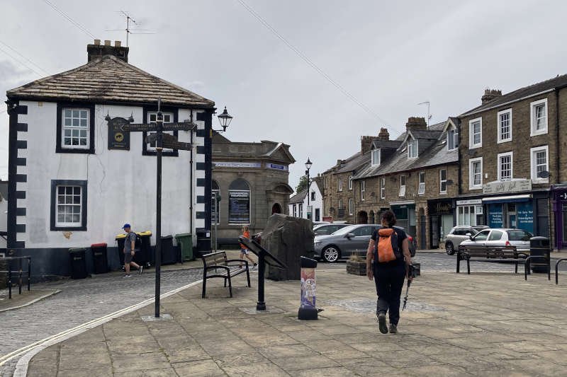
On the other side of the road, a track heads towards Lees Hall Farm. Beyond the farm it descends more steeply, eventually becoming a lane running alongside the wooded Haltwhistle Burn. There’s a sharp rise after the old brickworks before continuing downhill through streets into Haltwhistle, threading past Sainsbury’s, into the Market Square.
Haltwhistle has a fascinating medieval history, particularly with regard to the lawless years of the c16th Border Reivers. Many of its buildings – including the laundrette – are former bastles and strong-houses. They retain distinctive architectural features associated with such a troubled period. Look out for the informative plaques on the walls.
Despite its somewhat Victorian appearance, Haltwhistle’s Church of the Holy Cross was built in the c13th for Arbroath Abbey when Haltwhistle and the Tyne Valley – in the ‘Liberty of Tynedale’ – was held by the Kings of Scotland.
Nowadays, the town also makes a claim for being the geographical centre of Britain. It pinpoints this precisely with a large plaque set into the pavement of the Market Square around which you’ll find several hospitality options.
Haltwhistle to Lambley (9.3 km/5.8 miles)
The route leaves town via Black Bull Lane, past the Black Bull pub and Coronation Park, the Church of the Holy Cross, and Eden’s Lawn before crossing the main road (B6322). Interestingly, it’s thought that Eden’s Lawn may be derived from ‘Llan Aidan’ or ‘Aidan’s Church’ pre-dating its later dedication.
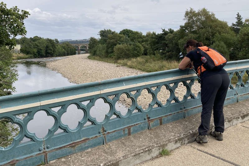
After passing under the Newcastle-Carlisle Railway the route arrives at the Haltwhistle Tyne Bridge known informally as ‘Blue Bridge’. The Grade II-listed, wrought iron structure was built in 1875, replacing an earlier wooden bridge dating from at least 1826. Financed by public subscription it closed to traffic in 1972.
The bridge spans the River South Tyne which accompanies the remainder of the route. It rises not too far away in the Pennines above Alston – England’s joint-highest market town. The River North Tyne – flowing from Kielder – joins at Warden, near Hexham where they both become the River Tyne.
Turning right, after crossing the bridge, a quiet lane leads under the A69 bypass on Bellister Haugh. Nearby is Bellister Castle, a Grade I-listed c19th mansion with stonework originating to a c13th hall house. Now owned by the National Trust it stands on the site of what may have been an even earlier Norman motte-and-bailey castle.
On the other side of the bypass you’ll find the River Tyne Trail (RTT) which I’d opted to use in order to follow the course of the river. The nearby South Tyne Trail (STT) offers an equally pleasant, but very different alternative, using the track bed of the former Alston Railway that once ran between Haltwhistle and Lambley Viaduct. The STT takes you over the viaduct (from where you’ll have to partly descend) while the RTT takes you to its foot.
I failed to spot on the map that the RTT pitches steeply up and down near the start, on a mile-long section of the trail through North Wood. This was slightly embarrassing as I’d promised the moosus an ‘easy’ finish. After reaching the road at Park Burnfoot the anticipated flat terrain finally kicks in persisting, more or less, all the way to the viaduct.
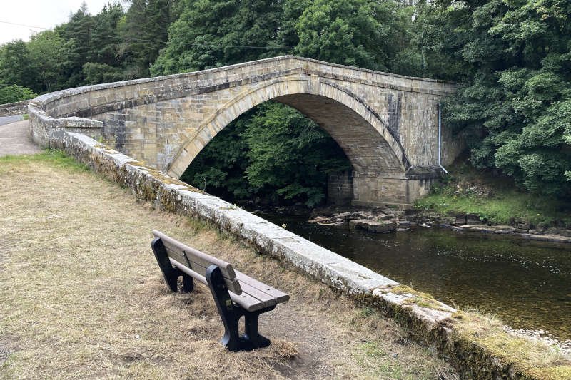
Apart from tracking the course of the river, the RTT offers several features not available to the STT, all of which are excellent distractions for tired feet. First is the steeply arched, Grade II-listed Featherstone Bridge. It was built in 1780 to replace one of many bridges destroyed across the North East in the catastrophic Great Flood of 1771.
Opposite is Bridge End House which was built in 1840 and is also Grade II-listed. We sat here for a few minutes in warm, evening sunshine watching a couple of Grey Wagtails doing their thing on the riverbank.
A bit further upstream is Featherstone Footbridge or ‘Castle Bridge’ as it’s known locally. In the woodland on the other side is Bishop’s Linn, a waterfall that sits on the Glencun Burn which we’d crossed earlier in the day at its source on Hartleyburn Common. Had we had a bit more time I might have tried to find it.
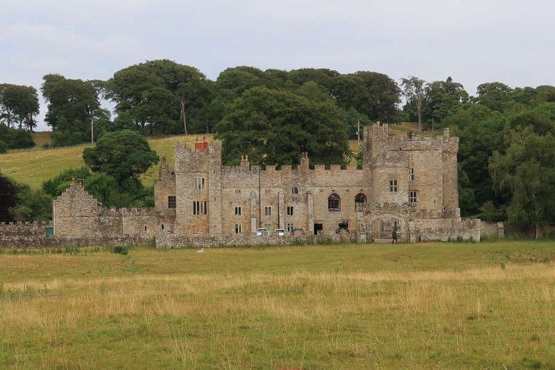
Featherstone Castle, across the park, started life as a c13th hall-house although most of what can be seen today is early c19th ‘castellated Gothic’ style. It does however, retain some original features such as the SW tower on the right-hand side of the main building. Previously it was a public school but now operates commercially as a venue for conferences and wedding receptions.
Despite the castle’s best efforts to steal the limelight, the most intriguing aspect of this part of the route, for me, is what went on in its grounds in later years. During World War II the park became the site for a prisoner-of-war (POW) transit camp holding Italian and German prisoners. In the months leading up to D-Day, it was converted to a training facility for US soldiers.
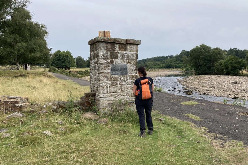
It was after the war finished in 1945, that Camp 18 (as it was known officially) really came into its own – as a re-education centre for politicized German officers many of whom had been, and possibly still were, ardent Nazis. An interesting plaque, installed on a surviving gate pillar in 1982, gives more information. At its height the camp held around 4000 German officers and their orderlies. The final inmates left in 1948, three years after the war ended. Several buildings and footings survive.
Beyond the camp you come to a road at Diamond Oak Bridge which was built in 1975 to improve transport links in South Tynedale after the railway closed. Out of sight across the river, when the route returns to the riverbank, is the aforementioned Lambley Farm and the adjacent site of the c12th nunnery.
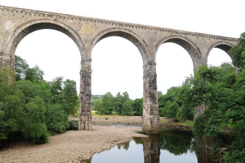
All that remains now is a pleasant riverside ramble to the base of the soaring Lambley Viaduct. At 33 metres high with a 260 metre span, it opened in November 1852 to carry the Alston branch of the Newcastle & Carlisle Railway. In those days the design incorporated a wooden footbridge attached to the base of its pillars.
The present footbridge was constructed in 1992 and is the second to have been moved further downstream. In this case it was to avoid the danger of falling masonry as the bridge declined after the line closed in 1976. Since 1983, the track bed has been used by the South Tyne Trail (walkers and cyclists) and the South Tynedale Railway, a heritage line that runs between Slaggyford and Alston.
After crossing the river there’s a very steep ascent out of the gorge – aided by several flights of steps – to reach the track bed of the railway that once serviced Lambley Colliery. A gate above the track gives access to a trail that will take you back across fields to Lambley.
Conclusion
Of the many walks I’ve put together for us, this might be my best so far. It’s feature-packed historically and geologically; it’s challenging but not too extreme, with constantly varying terrain. The views for at least half the route are superb (weather depending) and, as I’ve said already, it divides neatly into three sections of about 6 miles with multiple hospitality options at each.
To get the best from it will require a reasonable level of walking fitness and a willingness to deal with changeable weather. You may even find yourself wandering off the trail to explore other locations. The easiest direction, in my opinion, is clockwise as we did it. Parking is literally free and easy where, unless this route becomes too popular, you’re unlikely to be the cause of overcrowding.
October 21, 2026 @ 9:22 am
I’ve wanted to explore more of STT / RTT and this blog has given me some excellent information! I passed it briefly last year while on the LEJOG route with 2 friends after the tiring & windy Dufton to Alston leg with our 15kg packs.
October 22, 2026 @ 9:50 am
Pleased to know that you got something out of it Sue. Well done on the LEJOG with those packs. Try this one with a day pack – you’ll breeze it!