")
Dales High Way (Howgills)
Sunday 21st June 2026 | Today’s perambulation would be a Father’s Day hike suggested by our son, Niall, who’s accompanied us on many outings and hopefully will for many more. As usual, it was (happily) left to me to supply the route in what, for wider context, was the first week of the 2026 World Cup.
Taking potential weather and respective fitnesses into consideration my offering was a fairly challenging 17-mile clockwise circuit through the Howgill Fells. Starting and finishing at the Cross Keys Inn, north of Sedbergh, the route would head north via the Dales High Way to Ravenstonedale and back to include a short section on the Pennine Journey trail.
Significant features would include Cautley Spout, England’s highest cascade at 450 m/1490 ft (198 m/650 ft vertical length) and The Calf which, at 674 m, is the highest peak in the Howgills (both The Calf and nearby Yarlside qualify as ‘Marilyns’).
Going clockwise would mean that the hospitality options in Ravenstonedale would come in the second half, a situation preferred by all of us. Unfortunately that meant tackling Cautley Spout uphill – after less than a mile of walking.
Stats at a Glance
Distance 27.3 km/17 miles | Elevation Gain 905 m/2969 ft | Maximum Elevation 674 m/2211 ft | Profile Undulating with a severe ascent to start | Terrain Moorland, farmland, woodland, urban | Going Mainly firm with 5 miles of potentially (very) boggy ridge; trail, track and road | Exposure Mainly very exposed | Waymarking None (OS Explorer OL19) | Hospitality & Supplies Cross Keys Inn (Ca; B&B); Ravenstonedale (PH; B&B) | Start & Finish Cross Keys Inn, Sedbergh LA10 5NF; SD 698968; W3W:///politics.offline.slimming | Grade Challenge | GPS File
On the Trail
To provide a sense of place, the Howgill Fells are neatly constrained in a triangle between the M6 to the west, the A683 to the east (the side from which we started) and the A685 to the north. They’re more rounded and rolling than their Lakeland neighbours and wholly within the Yorkshire Dales National Park in Cumbria. Unlike much of the Lake District, on the other side of the M6, the bedrock is predominantly sedimentary: Ordivician/Silurian mudstone, siltstone and sandstone giving way to younger Carboniferous limestone along the northern boundary.
Cross Keys to The Calf (2.5 miles)
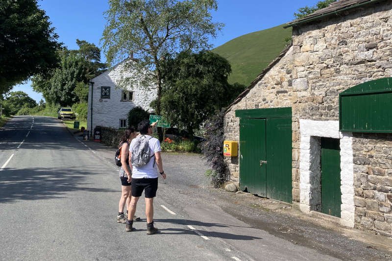
We parked at the Cross Keys Inn around 10 am where there’s sufficient free parking for a dozen or so cars. The 400-year-old former ‘temperance inn’ is owned by the National Trust. Now a tearoom, it sits above the River Rawthey overlooked by Cautley Spout. The precipitous, dark fan of rock to its left is a glacial feature known as a ‘cirque’.
The forecast was very warm with light winds increasing slightly into the afternoon. What little cloud there was initially would start to build by the time we left The Calf. However, it remained broken, allowing for plenty of sunshine. There would be little shade for most of the route so precautions would need to be taken. For me, that generally amounts to wearing a cap, reversed so that the peak covers the back of my neck. I always have a buff handy – useful for all sorts of occasions – but I’m no fan of creams which I carry but hardly ever use.
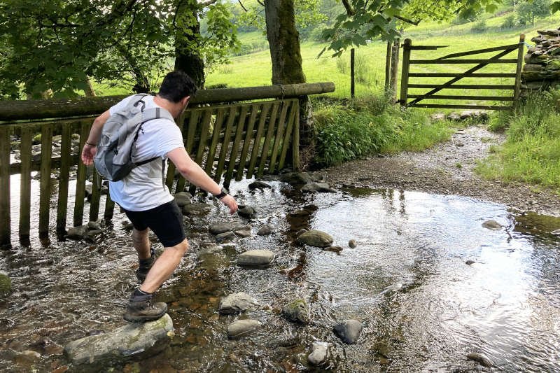
As soon as began walking, I had to question my memories of the location the moment we confronted the bridge across the river. It was much wider and better engineered than I remembered and appeared to be newly installed. My memory was of having to descend to cross it. Sure enough, on looking down to the right, there were the vestiges of an older bridge much as I’d remembered. Turns out that it had been replaced in November 2024 to provided multi-user access to a much improved path that ends at an interpretation board in front of Cautley Spout.
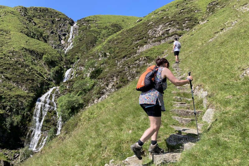
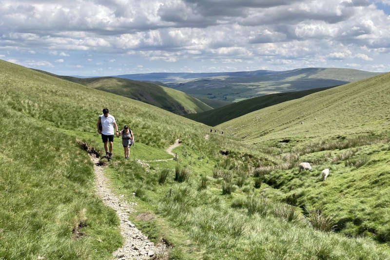
Beyond the board is the unsurfaced trail where, for me, the hike really starts. Approaching the mile mark heralds the most challenging section of the climb. A well-worn, rocky path, sometimes aided by rudimentary steps, offers a modicum of assistance but thighs and lower back will inevitably feel the effort.
Here it was that Diane began to think she might be overdoing it. She’s the first to say that going uphill isn’t her forte but it’s relative by her own high standards. She’ll usually manage fairly well, just a bit more slowly than me. Today however, she definitely looked out of sorts. Apart from turning back, the only thing she could do was take plenty of breaks as the day continued to warm up.
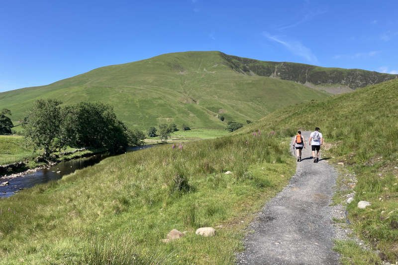
She persevered, as usual, and before long we found ourselves standing alongside Force Gill Beck which feeds Cautley Spout. At this level, across the valley, is Bowerdale Head where there’s a low-level route parallel to the one we’d be taking after The Calf. Far below, another large group was making good progress on the climb. I found it hard to resist the urge to begin racing for the top.
It’s another mile, following the beck upwards, to reach the ridge and the Dales High Way. Mine and Niall’s main concern at the time were the large flies landing on us, in great numbers. What I very briefly took to be horse flies or ‘clegs’ were actually snipe flies, specifically downlooker snipe-flies. They’re predatory but don’t bite humans – as I quickly realised. Clegs do however, as I’m all to well aware and as I’d experience again later.
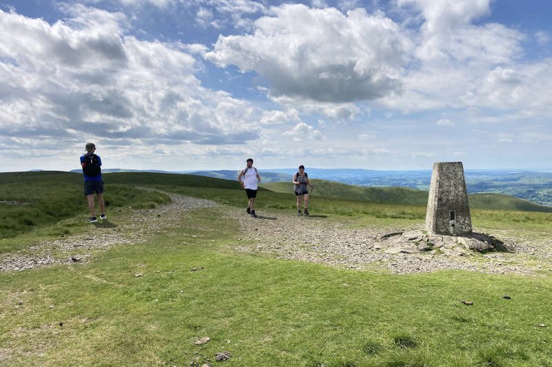
Reaching the path along the ridge is just like peeking over a wall, revealing sweeping views of the Lake District and the sea at Morecambe Bay. It was a major relief for Diane given the way she was feeling but there remained a further, short, climb to gain the trig point at The Calf’s summit [2.5 miles].
The Calf to Bowderdale Head (5.5 miles)
On a day such as it was, the 360º panorama from The Calf is predictably magnificent with the imminent route laid out before you – a long undulating ridge, stretching north to the edge of the Howgills. On a more typical day, with ‘clag’ covering the tops, you’ll be able to see nothing whatsoever, nor any indication as to which way you might proceed. Nevertheless, I checked the compass just to be sure.
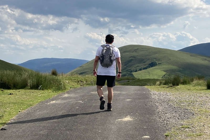
Specifically, the ridge ahead is about four miles long (page head photograph) with a further mile downhill to the hamlet at Bowderdale [8 miles]. The two most prominent rises are Hazelgill Knott (561 m) [4 miles] and West Fell (542 m) [6 miles]. If you’ve managed to ascend Cautley Spout, neither will present a challenge. Sloping steeply away to the west is the valley of Langdale.
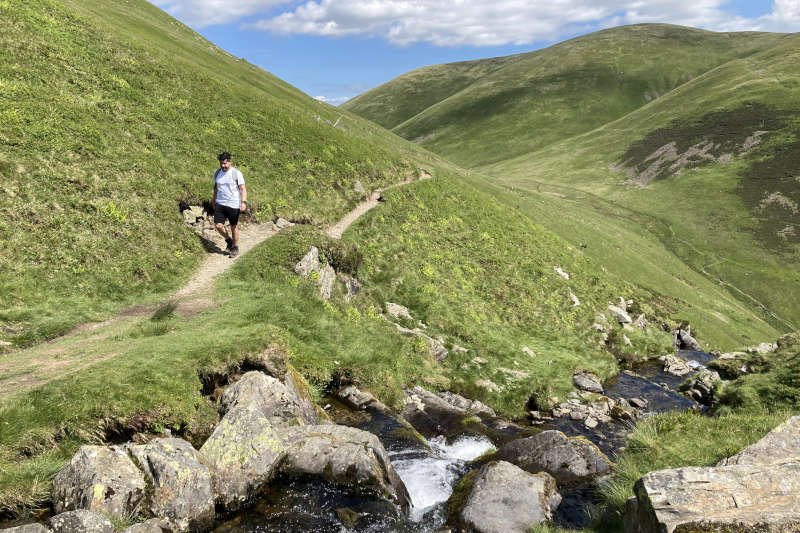
The path beyond the summit degrades quickly to a point where it becomes easy to lose. By looking ahead or waiting to see what appears close by you should be able to make your way fairly confidently. It’s grassy to the point of bogginess; in trail shoes, my feet were quickly soaked. In extended wet weather this section would be much more of a slog.
In order to avoid poorer conditions on the tops, you have the option to descend back into Bowderdale to follow the parallel route mentioned earlier. A trail, of which I have no personal knowledge, leads directly down from The Calf (make sure you don’t mistakenly follow it if you’re intending to stick to the ridge – much easier to do in clag).
With Diane struggling on the climb it must have taken us around a couple hours to reach The Calf. By now she seemed to have recovered and regained something of her usual walking composure. Unfortunately she was still dealing with physical issues that would ultimately shape the day for her.
Bowderdale Head to Ravenstonedale (3 miles)
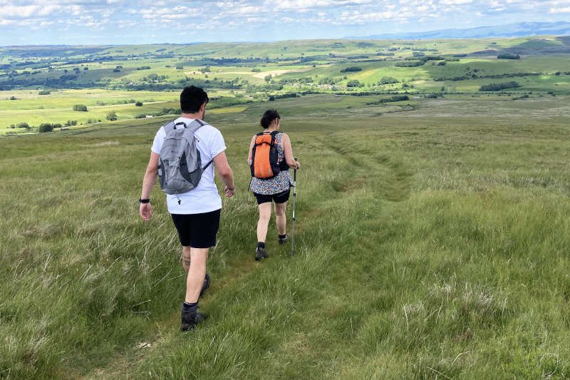
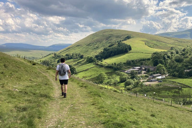
It’s a long way down from West Fell, at the end of the ridge, to Bowderdale (everything associated with Bowderdale seems to be called Bowderdale or Bowderdale Head, irrespective of which end of the valley it’s at). The trail is soft and easy underfoot, the gradient fairly shallow, with fell eventually giving way to fields. Somewhere along the farm tracks I received my first bite from a real cleg – on my hand – which immediately put us all on high alert. After that, every tiny sensory impression received a vicious slap.
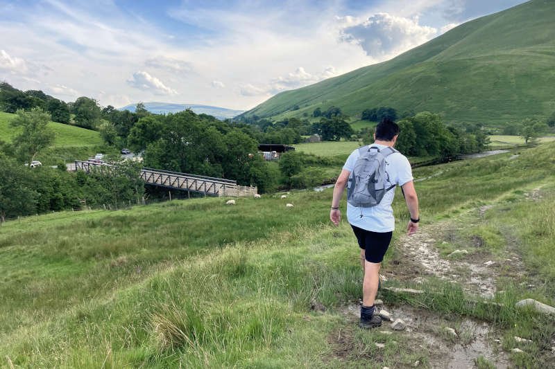
Joining the road at Bowderdale heralds around 6 miles of road walking. Traffic on the approaching A685 is busy and fast-moving. The underpass, however, offers convenient access to the hamlet at Wath where you also cross the nascent River Lune.
After a short rise up to Low Lane there’s about a mile more of quiet asphalt back to the A685. Although there’s no underpass this time, there’s a well-sited pedestrian island.
Across the road is Newbiggin-on-Lune [10 miles], a medieval village dating to the c12th. Its character and prosperity improved only when the South Durham and Lancashire Union Railway brought the Stainmore Line to the village in 1861. Most of what I now know about Newbiggin comes from the interpretation board in the village which notably informed me that St Helen’s Well is one of several nearby sources of the River Lune.
Ravenstonedale to Cross Keys (6 miles)
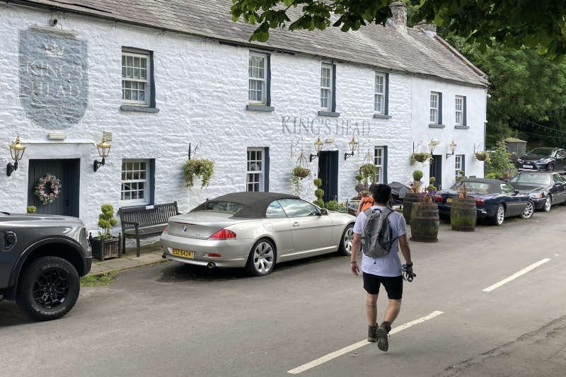
Little more than a mile away lies Ravenstonedale – or ‘Russendale’ to give it an earlier name. Historically, there’s little to learn about it which I find strange as it has an air of antiquity. Its most profound link with the past seems to be the ruined c12th Gilbertine Priory in the grounds of St Oswald’s Church. While the church itself is Grade I-listed, most of the information I could find refers to its c18th century restoration and less about its Norman origins.
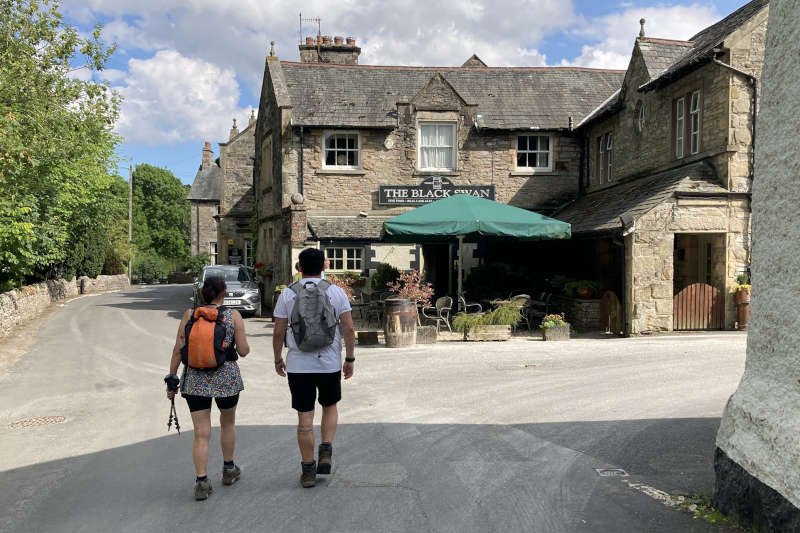
Probably the most important features in the village, for the casual walker, are its two excellent hostelries. There’s the King’s Head, where we stopped for a drink on this occasion, and the Black Swan where I’ve spent time in the past.
Given the weather, we chose to sit outside, alongside the Lockholme Beck. I was surprised to learn later, that the beck is one of several nearby sources for the River Eden rather than the River Lune – even though they’re only about a mile apart. As watersheds go it’s a flat one with the Eden departing north-west, heading for the Solway Firth.
The break gave Diane an opportunity to assess her niggles which appeared to have much to do with cramp in her feet. Although there was only 6 miles to go, a third of them were on the road and steeply uphill. There was however, a shorter option of around 2 miles to The Fat Lamb Inn at Crossbank where she elected to wait until we could pick her up on our way home.
I was surprised at her choice because it’s not like Diane to miss out on any event or opportunity. Given that she’d probably be waiting for a couple of hours, she must have been particularly uncomfortable.
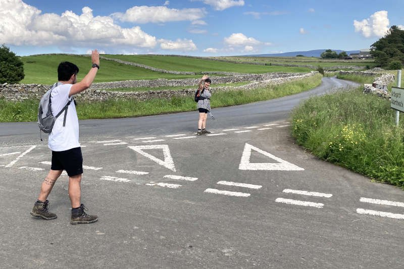
We parted ways on the edge of Town Head, at the junction of Townhead Lane with the road to Adamthwaite. I advised she take her time on the remaining 1.5 miles to the inn as we had 5 to complete with the potential for anything to happen, nor was I sure what phone signal there might be.
With a renewed objective of covering the final five miles as optimally as we could, Niall and I struck out southwards. Crossing the Lockholme Beck, with which we’d become acquainted earlier, my attention was drawn to the flood indicator alongside the ford. The markings on it together with the height at which it had been installed suggested the potential for preposterously high water levels. Thankfully, it wasn’t a problem today.
The next two miles to the summit are on a quiet, metalled lane almost all of which is uphill. It passed fairly quickly for us though, as we were able to focus on increasing our pace. Immediately beyond the bridge at Gais Gill there’s a short but much steeper section which I’d be surprised to learn is less than 20%. It would certainly have gained my attention had I been cycling, though not so much on foot.
A few hundred metres after that we bore left, leaving the road for a rocky bridleway around the flank of Harter Fell. Had we continued down the lane to Adamthwaite there are a couple of route alternatives which seem fairly decent though I can’t vouch for either.
Unable to avoid several large puddles, each enclosed by a wall on one side and an large patch of bog on the other, my feet – long dry – unhappily returned to their former soggy state. Otherwise, progress on our chosen option was good – mostly downhill – as we headed towards the farm at Murthwaite [15 miles]. Here we joined Alfred Wainwright’s familiar ‘A Pennine Journey’ trail, frequently encountered on my walks in the North Pennines as it’s so extensive. It would take us the final couple of miles back to the car.
A point on navigation: as you approach the farm there’s a fingerpost pointing to a gate on the right. Go through the waymarked gate indicated, into the paddock and bear left. The trail disappears through the long grass (full of nettles) in the corner. There’s another waymarked gate beyond that, after which the trail is followed easily. It was the only point on the route where navigation wasn’t straightforward.
After passing steeply downhill through woodland at Murthwaite Park comes the first of two fords, this one on the Wandale Beck. Don’t stress too much about keeping your feet dry as the next is considerably wider.
Once you’ve clear of the trail across the field, a brief ascent on a stony track leads you into a farmyard at Narthwaite. The lady farmer to whom we chatted is very friendly but I was distracted by having to get back to Diane as quickly as we could.
You bear left through the metal gate ahead and left again to regain the trail. This leads steeply downhill to the second ford – on Backside Beck. There are stones but they’re random and slippery. My feet were already wet so I had nothing to lose. It’s a shame because from there it’s only about half a mile to the Cross Keys Inn.
Conclusion
Would I recommend this route? Absolutely, but only if you’re fit enough to deal with what is effectively a 2.5 mile ascent, with no breaks at all after the main ascent begins. Once you’re at the summit of The Calf most of your climbing is done – of the more extreme variety anyway. For me, the anticlockwise option isn’t as inviting: the hospitality is too early, there’s an exposed 5-mile, boggy drag onto The Calf with a long, steep descent that will expose weakening knees, to finish. Clockwise for me, any day.
As far as Diane was concerned, I might have been over-ambitious in my offering. Cautley Spout is a taxing climb in any weather; more so if it’s hot. We hadn’t done much to prepare for it so perhaps something more gentle would have been wiser. Exposure works either way: whether it’s hot or cold. You need to be prepared for the conditions.
Without GPS, the route is much easier – and safer – in clear weather. The more visibility (as on this occasion) the better. The Howgills offer some of the finest walking in the UK. However, in mist or even intermittent low cloud, the wide, rolling summits and ridges can be confusing unless you’ve got appropriate navigational aids or confidence with map and compass.
Watercourses were well stocked despite the warm weather. Wherever they pooled, particularly on the becks feeding Cautley Spout, the water was deep, crystal clear and, as far as I’m concerned, eminently drinkable. Maintaining hydration would have been no problem as far as The Calf but thereafter you’d need to rely on what was carried until Ravestonedale.