Parkhead & Bollihope
Sunday 10th May 2026 | With the price of diesel currently around £1.88 per litre I’m increasingly inclined to keep our activities a bit closer to home until the situation resolves – or we get used to the prices. Recently however, I’d noticed a post on Facebook saying that the temporarily closed White Kirkley Footbridge on Section 5 of the Weardale Way had been repaired and reopened.
Given that this bridge over the Bollihope Burn is quite a significant one on the trail (particularly if the burn is in spate) I thought I’d go up and have a look for myself at the earliest convenient opportunity. Rather than drive up specifically to see the bridge, or walk (for the umpteenth time) a rather obvious high/low loop, I thought we might do something a bit longer and more challenging.
By starting and finishing at Frosterley we could ascend the steep north side of the dale (a route I’ve never done before) and cross Wolsingham Park Moor to visit the cafe at Parkhead on the C2C/Waskerley Way. We’d then head downhill to Stanhope for an alcoholic beverage (should we feel inclined) before crossing the River Wear and returning to Frosterley via the Weardale Way. This would take us directly to the footbridge, the focal point of the day.
As hiking routes go, I consider this to be quite tough: it’s either up or down (usually steep) and the ups are very exposed. If, like me, map and compass is your preferred method of navigation, the location’s an awkward one as a critical part of the route, over the open moor towards Parkhead, is split between two maps on both the OS Explorer and Landranger series.
Unfortunately it’s also the part of the route of which I’d no personal experience. So, for that reason, I decided to use the GPS for navigation though I didn’t bother loading the route onto it. Doing it this way meant that the short section of mapping I required was readily at hand if needed. In the event it turned out to be very useful.
Route map for Parkhead & Bollihope by Durham Cow on plotaroute.com
Stats at a Glance
Distance 21 km/13 miles | Elevation Gain 558 m/1831 ft | Maximum Elevation 499 m/1637 ft (W of Collier Law) |Going Generally firm with potentially muddy sections on trail, track, road | Terrain Moorland, farmland, woodland, urban | Exposure Mix of sheltered and very exposed | Navigation Weardale Way (S of the River Wear) (OS Explorer 307; Explorer OL31 | Hospitality & Supplies Frosterley (PH; GS); Parkhead (Ca); Stanhope (PH; Ca; GS) | Start & Finish Railway Station car-park, Frosterley, Weardale DL13 2SL; NZ 023369; W3W:///rungs.teaching.ironclad | Grade Challenge | GPS File
On the Trail
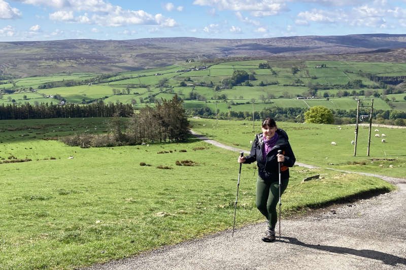
We arrived at the Weardale Railway’s car-park in Frosterley around 10 am in sunny, calm but cool conditions that were forecast to hold for as long as we’d be on the trail. The only issue we had all day occurred almost as soon as we’d left the car, when Diane realised she’d forgotten her walking poles.
While I took the opportunity to bask in an early morning sun-trap, Diane did an extra couple of hundred unrecorded metres back to the car. On her return, poles in hand, we had a short walk along the A689 which, together with the river running parallel, divides the route north and south.
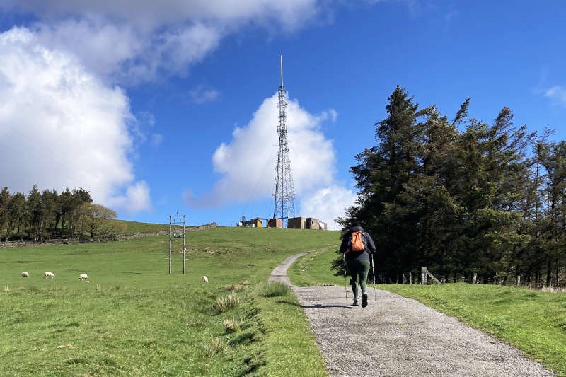
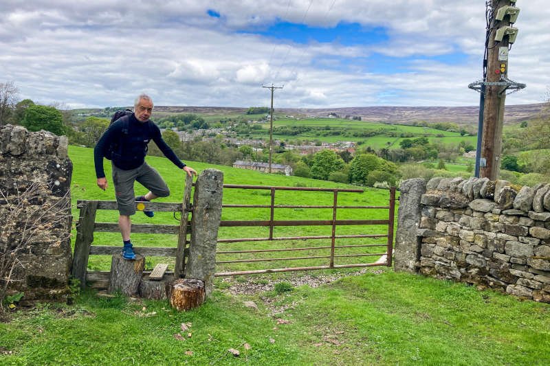
Just beyond the town’s western outskirts, we turned sharp right onto Intake Lane. This narrow, mile-long stretch of tarmac ascends 230 metres to the BBC Weardale transmitter, sitting at an elevation of around 400 m. I can confidently describe the lane as “unremittingly steep”.
If you decide to do this route yourself, when you reach the mast, take time to turn around and look directly across the valley. The big gouge in the side of the dale opposite is Parson Byers Quarry and, to the left, is the hill-top village of Hill End – this is where you’ll find yourself in a few hours time.
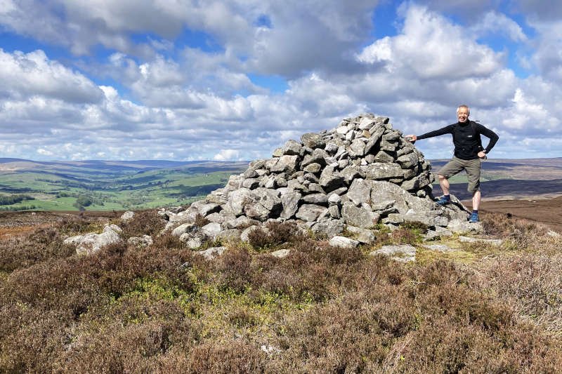
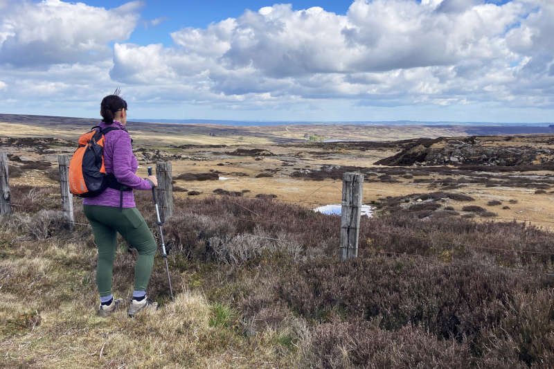
Beyond the mast is a tall A-frame stile where tarmac gives way to trail and the gradient is much gentler. It’s another mile exactly to the currick (cairn) on Fatherley Hill (459 m). Despite recent heavy rain, conditions on the trail, for us, were excellent but there’s the potential for them to be a great deal slimier.
Parkhead
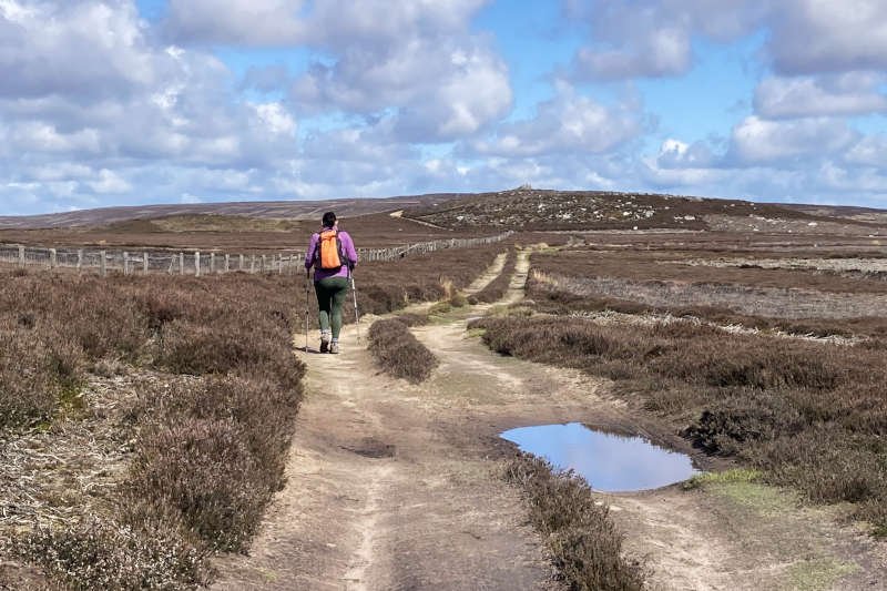
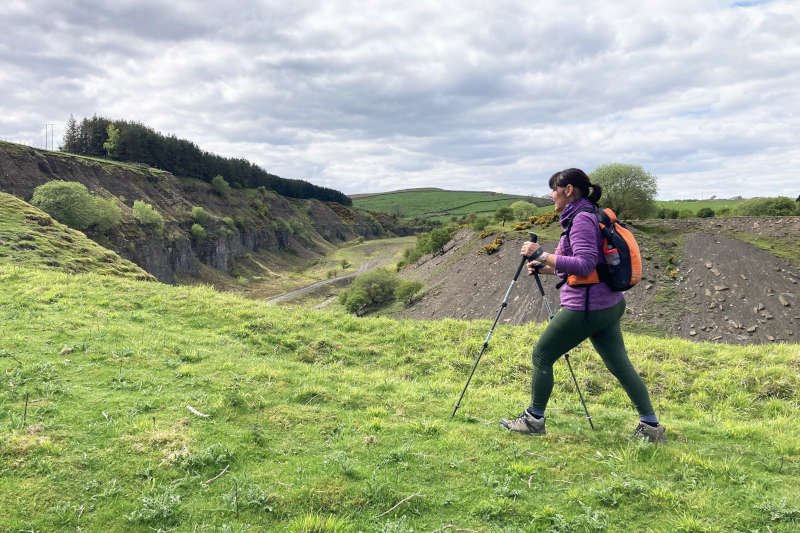
Navigationally, the general idea for this part of the route is to follow the main trail along the boundary fence before jumping across (where the main trail veers right) to a gate through it. This will take you west of Collier Law to join an access track. At the highest point of the route, above Millstone Quarries approaching the 4-mile mark, the track turns sharply left, downhill.
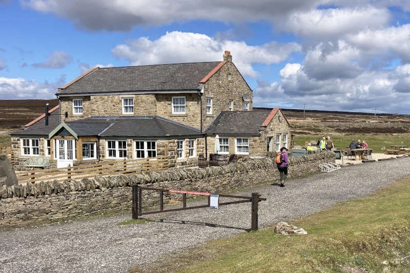
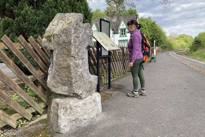
Continue off the track at the corner, bearing slightly right across the heather to pick up a narrow trail that runs alongside the boundary fence. Follow this downhill, past Dursand Quarry (quarries at this height typically extracted sand) to eventually pick up a grassy track leading to the (fairly) recently reopened cafe on the C2C/Waskerley Way.
We’d already decided that we’d stop for a hot drink at the cafe then continue 2.75 miles downhill to Stanhope following, for the greater part, the track bed of the former Weather Hill railway incline. At its base is the notoriously steep Crawleyside Bank where you can still see remnants of another railway incline that once crossed the road.
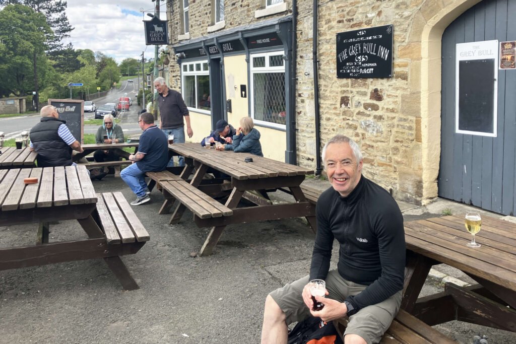
Although there’s good access into town via trails around Ashes Quarry, we decided on the most direct route, steeply downhill on the road. You’ll find the Grey Bull pub on the corner of the B6278 (Crawleyside Bank) and the A689 through Stanhope. It’s popular with passers-by of all types (often seen sitting at the many tables on the roadside) and has a good selection of beers.
Stanhope
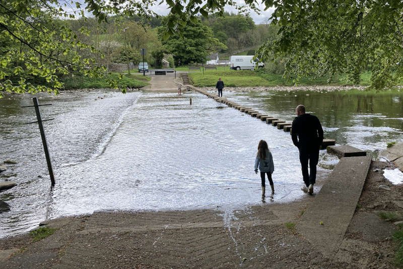
We stopped long enough to down a half-pint then crossed the busy A689 heading in the direction of Stanhope’s precariously viable outdoor swimming pool which, as far as I’m aware, is usually closed. On the other side of the River Wear we’d begin the slightly shorter, second half of the route following the way-marked Weardale Way to White Kirkley. All we had to do was wait for a gap in the human traffic using the stepping-stones across the river alongside the now blocked-off ford.
Much detail of the remainder of this route can be found on our Weardale Way Section 5 page but I take any opportunity to draw attention to c16th Unthank Hall sitting, as it has done for over four hundred years, a short distance from the ford, across the river from the town.
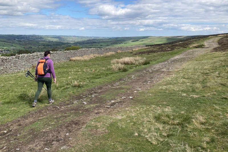
The highest point on this side of the river comes at around 10.5 miles, just before High Bishopley. The most arduous point is the trail around the side and across the top of Parson Byers Quarry. It’s a long, steep ascent, all the way to the gate onto Catterick Fell. In summer, the foot of the trail can be concealed by vegetation making it difficult to locate unless you know what you’re looking for.
High Bishopley
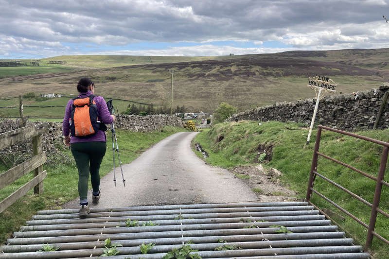
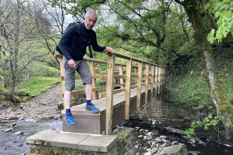
Walking alongside the wall on the edge of the fell is easy if exposed. All of the major climbs are behind you as is, hopefully, the wind. Beyond the barking dogs at Hill Top House comes a steep descent on an access road to the caravan park at Low Bollihope where you’ll meet the Bollihope Burn. Access along this part of the Weardale Way has been restricted for about a year due to the closure of the footbridge at White Kirkley (the footbridge at Pye Close was closed at the same time though it didn’t influence the Weardale Way).
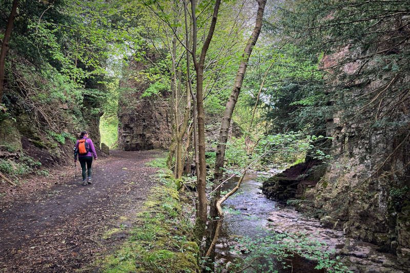
The trail at this point is the former track bed of the Bishopley branch of the Weardale Valley Railway built to service Fine Burn Quarry. Like Parson Byers it provided limestone for Teesside’s iron and steel industry. It’s one of my favourite parts of the Weardale Way where the Great Limestone has been eroded gently into smooth platforms by the burn’s rushing waters. Further along, near the impressive man-made cutting, you can see tunnels, or ‘adits’, dug into Slitt Vein, the most significant mineral vein in Weardale.
White Kirkley & Low Bollihope
The going is easy now and shortly after the cutting comes the footbridge. For some reason, I was quite pleased to see that little had changed. The conformation of the bridge was the same, with the characteristic ‘kink’ part-way across. It seemed that the rotten timbers have been replaced, generally with wood but with additional materials for a longer-term fix.
The only issue I would draw attention to is a deep step at the White Kirkley end. I think it might challenge the single-leg strength of some people, particularly those carrying packs. Additionally, the part of the trail between the bridge and the road at White Kirkley appears to have been ‘landscaped’ to a degree. It certainly looks a bit less ‘farm-like’ and muddy than I’m familiar with.
Frosterley
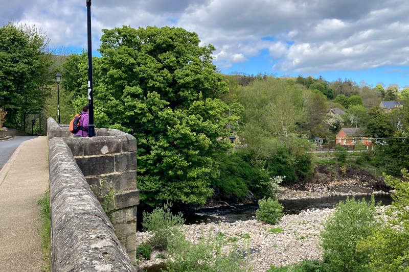
We could easily have extended the walk by various routes through Broadwood Quarry and approached Frosterley from the east. The plan however, had always been to head directly back to the car-park (slightly less than a mile away) on the lane from White Kirkley. It seemed that Diane’s left knee had got the memo, so to speak, which made up our minds and back we went, stopping only to muse on the pleasant view from the bridge – of the river and Frosterley’s ‘plainly attractive’ station.
Conclusion
Both of us enjoyed what turned out be a challenging variation on an otherwise familiar trail. I particularly enjoy local routes that offer features with which I’m unfamiliar – you don’t have to go miles from home to get excited about what might be over the next hill or around the next corner.
As we often do for walks that involve a significant degree of exposure, we paid close attention to the weather forecast, particularly for rain. The clear, calm conditions we had were ideal and helped keep the mood relaxed.
Hospitality options are lumped together somewhat but it actually worked well. The route is arduous for extended sections but that was all part of the plan beyond visiting the bridge. Views of, and around, the entire route are great; definitely one for a nice day.