
Dufton to Cow Green
| 10th August 2025 | This general update for walkers concerns current access and navigation on Section 1 of the Teesdale Way (Dufton to Cow Green) with particular regard to where it differs from what might be published elsewhere on this site or in our Teesdale Way Pocket Guide.
Local conditions and heavy use quickly degrade infrastructure – particularly timber – causing impromptu and possibly persisting access and/or navigation issues. The chances of the trail changing in some way – short and long-term – is even more likely in urban areas. If your experience is different to what we’ve published here, you can help by leaving your insights in the comments.
Conclusion
The first (or last) section of the Teesdale Way is also the longest and is the first of three that follow the Pennine Way between Dufton, in Cumbria, and Middleton-in-Teesdale, Co. Durham. Being a National Trail, the Pennine Way has always been relatively well-maintained compared to trails like the Teesdale Way and Weardale Way. All way-marking on these sections is for the Pennine Way and the route remains exactly as published in our 2021 guide. Follow it easily with a GPS file from The Durham Cow.
One significant change, which doesn’t affect the route directly, has been the closure of Dufton YHA in 2023. It’s not clear what its present status is but the YHA website no longer lists an option for Dufton so I have to assume that it remains closed. Unfortunately we didn’t think to investigate the location itself during our review but it doesn’t look good. Shame, I liked Dufton YHA. The Stag Inn is still thriving though and, although the Post Box Pantry cafe was closed when we were there on a Sunday, it looks like it’s still in business.
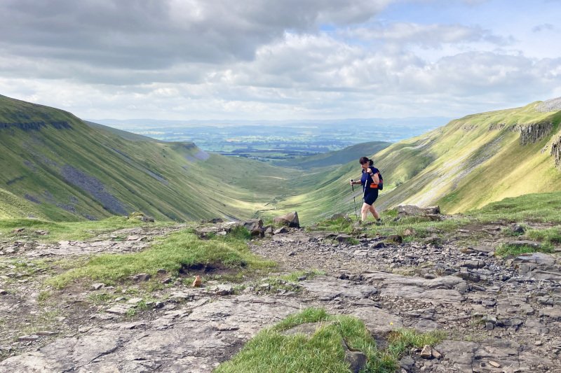
Back to the trail itself, most of this section is on Open Access Land with less infrastructure than on any other section. The most significant for walkers are the two bridges over the Maize Beck either at Maize Beck Scar, on the “Flood Route” or, most likely, the bridge on the main trail further downstream. We didn’t try the bridge over Maize Beck Scar but the bridge on the main route remains in good repair as does all of the other infrastructure we encountered.
We reviewed the section after a lengthy spell of reasonably dry weather when the trail was generally firm. In wet weather it can be very boggy especially between High Cup Head and the access track above Moss Shop. The well consolidated access track leads directly to the road beyond Birkdale Farm hence will provide good going in all weather.
That’s it for Section 1. We hope this helps. If you have anything to add please feel free to do it in the comments. Happy Walking!
Gallery
View a comprehensive selection of images for Section 1 taken on the day(s) of the update in our Google Gallery.