
11th June 2022
Route map for NYM 2-Abbey Tour (Day 1) by Durham Cow on plotaroute.com
Route map for NYM 2-Abbey Tour (Day 1) by Durham Cow on plotaroute.com
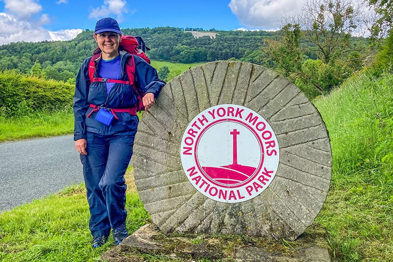
With 40 mph winds suddenly and unexpectedly forecast for the Cheviots in Northern England, Diane and I made a quick decision to abandon our planned camping trip to Wooler, in Northumberland, and drive the short distance back home for a re-think. An hour-and-a-half later we were heading in the opposite direction, on a sixty-mile drive to Kilburn in the North York Moors from where I’d rapidly planned a modest two-day hike to visit the ruined Cistercian abbeys at Byland and Rievaulx, camping overnight in the grounds of the youth hostel (YHA) at Helmsley.
The main purpose of the weekend had been to test our camping equipment – new and old – while getting in a bit of training for our upcoming ten-day trip along the Southern Upland Way. We’d intended to do this on a fairly tough circuit in the Cheviots, utilising the Pennine Way (which we’d reach via the tough climb of The Cheviot itself) and returning via St. Cuthbert’s Way after wild-camping overnight. However, neither of us fancied dealing with the prospect of such high winds.
The revised scenario would be much more relaxed, providing easy camping together with use of the YHA’s facilities and probably would have been the better option in the first place. It wouldn’t be flat though: the geography of the NYM is undulating to say the least, with deep dales separated by steep ridges. Nevertheless, we’d be able to focus on the details without the consequences of failure being nearly as uncomfortable.
On arriving in Kilburn, which is in the administrative district of Hambleton (almost all of the other places we’d visit would be in Ryedale, including the dale itself), we drove straight through and parked in a secluded spot half a mile to the north, on a quiet lane known as Oldstead Road. High on the hillside is arguably the North York Moors’ most identifiable feature – the White Horse of Kilburn. Scraped out of the precipitous flank of Roulston Scar, the figure covers an area of 1.6 acres and is visible from all over the Vale of Mowbray between York and Thirsk. It was created in 1857 by a local schoolmaster together with a troop of volunteers, and financed by a certain Thomas Tipping who wished to emulate more ancient rock art around the country.
Unlike the ancient figures it’s based on, which are cut into white chalk, Kilburn’s grey, Jurassic bedrock requires the horse to be groomed regularly with off-white limestone or chalk from the Yorkshire Wolds (depending on which account you believe). Being unaware of its relative lack of antiquity I’ve always been a big fan, seeing it as a ‘welcome home’ sign on journeys up the A1M from the south. Anyway, it was a nice way to start our improvised two-day meander around the North York Moors National Park.
Returning to Kilburn on foot, we quickly encountered evidence of its second most famous resident: Robert ‘Mousey’ Thompson was a talented carpenter who became known as ‘The Mouseman’. By the time he died in 1955, at the age of 79, his fine oak furniture and fittings had become highly sought after. Every piece he created (or at least most of them) was instantly identifiable not so much by its style, but by the frivolous inclusion of a delightfully carved mouse which has since become the firm’s registered trademark. Robert Thompson’s Craftsmen Ltd still has its factory and showroom in Kilburn. opposite The Mouseman Visitor Centre (pictured).
Our first objective on leaving Kilburn was the ruined abbey at Byland which came after only four miles. I’d visited this one by car a couple of years earlier – just popping in as I was passing because it’s situated close to the road just outside the village of Wass. The most immediate feature of this surprisingly large site (especially when viewed from the air) is the now semi-circular form of what would have been a majestic circular window. It was destroyed along with the abbey during Henry VIII’s suppression of the monasteries in 1538-40, a fate which other great abbeys including neighbouring Rievaulx. Nevertheless, what remains provides a distinctive landmark that peeks up well above the hedgerows.
With the intention being to focus on quality rather than quantity we’d been anticipating our first break at the Byland Abbey Inn – opposite the abbey itself – only to find it closed and a bailiffs’ notice taped against the window of one of the doors. In the time we were there a stream of potential customers came and went, making us wonder how the situation had developed in the first place. With nothing to be done we availed ourselves of the garden furniture to brew-up our own hot drinks while being checked out by an endearingly friendly smoky-grey cat. As we departed we noticed a couple having their wedding photographs taken at the abbey and hoped they hadn’t booked the reception at the inn…
We reached the village of Ampleforth (best known for its contemporary Benedictine abbey and monastery as well as the associated boarding school) after a stiff climb and a couple of minor distractions but too late to comfortably relax in the cafe which was due to close at 4.00 pm. Instead we crossed the road to sit under a large sycamore where we removed our packs and drank some of the water we were carrying. For a day-hike I’d normally carry carbonated water but because we’d been expecting to wild-camp I had to content myself with ‘ordinary’ water on this occasion.
After about 10 minutes we decided to move on, bearing left on the road up Beacon Bank for a 600 m pull to the top of a spur which runs SE towards Oswaldkirk and which we had to cross to reach our next objective, the village of Sproxton (it wasn’t lost on me that, had we continued through Ampleforth, we could have made it a three-abbey tour). At the top, our way was indicated by a fingerpost where we regained the trail and began a long descent over several fields each of which had its own distinct character: at first we were thigh-high in barley, then up to our chests in rape-seed (both would have required waterproofs if there had been any rain). Next came carefully mown walks belonging to a campsite followed by fields of lower standing crops and finally, on reaching the bottom of the hill, grazing – complete with sheep.
After crossing one more, final, field of crops we reached Hag Lane which led us steeply up to the busy and footpathless B1257. A hundred metres later, we turned right – glad to get off the road – into Sproxton. The c17th church of St Chad has only nine pews and had been moved – stone by stone – from nearby West Newton Grange to its present spot in 1879. I’ve also just learned that we missed out on seeing a decorative arch that functions as the south gate into Duncombe Park (which was all that was separating us from Helmsley a couple of kilometres along the road). Known as Nelson Gate, the arch was constructed in 1806 in commemoration of Admiral Lord Nelson after his victory and death at the Battle of Trafalgar (there’s also a Waterloo Plantation). That sort of thing is right up my alley so to speak – I’ll definitely check it out next time I’m in the area.
Despite there being little mention of the rain in the forecast, clouds had been building steadily for the last twenty minutes or so and the rain finally caught up with us in Sproxton. As it began to get heavier we took the opportunity to rest on a conveniently steep, grassy verge beneath a neatly clipped tree overhanging the boundary of its garden by just enough to offer a perfect ‘D’ of dry ground. From the look of the sky it was fairly obvious that it was only a heavy shower and sure enough – after about five minutes – clouds and rain had moved on. By the time the sun reappeared we’d left the village, past the Grade II-listed Forge Cottage with its thickly thatched roof more reminiscent of Southern England, the distinctive village hall that looks like a WWII Nissen Hut but is dated 1949, and finally, Sproxton Hall, the most distinguishing feature of which was the magnificent copper beech which sprawled over the lane.
No sooner had we left the village than we joined the Ebor Way, a 70-mile trail between Helmsley and Ilkley, in West Yorkshire, which links the Cleveland Way with the Dales Way and which would comprise the final few kilometres of our route today. Though we’d spent most of the day walking in what is administratively classed as Ryedale, it was only now – just as Diane (a keen forager) had frustratingly (for her) located a large outcrop of ‘Chicken of the Woods’ (a type of mushroom) halfway up a tree – that we encountered the River Rye itself. That fact completely passed me by – despite the map in my hand – as it’s certainly not the widest of rivers but it makes up for it in its meandering and is as attractive as I’d expect it to be.
A footbridge conducted us over the river and alongside a fish farm which turned out to be a twitcher’s paradise: despite the ponds being extravagantly defended with nets, we counted three or four herons around the place, all of which looked suspiciously well-fed. As the novelty began to wear off, we moved on, keen to cover the final couple of kilometres to Helmsley and our hostel campsite. By now it was approaching 6 pm and the easy walking on a well-worn trail, along the meandering river’s grassy floodplain, in warm evening sunshine was a joy.
We found ourselves entering the town almost too soon which meant we had turn our attention to finding the hostel itself. Even though we navigated directly to it it’s not visible from the direction in which we approached. With doubt creeping in Diane reached for her phone but – being a map and compass man – I wasn’t about to crack as easily as that and as she was scanning her apps I walked around the corner and immediately encountered the familiar, green YHA logo inviting us into the hostel directly behind the tall hedge behind us.
The last time we’d been in a YHA had been a cold, gloomy experience, in the dark shadow of the Covid-inspired crisis, but this was more like the old days: the manager was open and friendly and after the normal formalities (photo ID required) he showed us around the hostel and took us outside to a compact campsite where there were a few tents already erected but with excellent pitches still available. This was going to be a great deal more comfortable than battling against 40 mph winds on The Cheviot.
Ten minutes later the tent was up and we were in the well appointed kitchen making our evening meal. On the menu was lamb curry and rice, which we’d dehydrated at home. Neither of us include primary sources of carbohydrate in our diet so the ‘rice’ was actually riced cauliflower which is surprisingly good in normal circumstances. In my opinion, eating, like many things, is all about context and while both of us enjoyed our meal, we probably wouldn’t serve it to guests or even eat it ourselves at home – but then you wouldn’t do that with a commercially dehydrated meal would you? We’d also brought full-fat greek yoghurt, berries and nuts for dessert which is basically what I’d eat at home, so that went down well.
After dutifully washing and cleaning up after ourselves we sauntered up the road to the town’s expansive marketplace where we made ourselves comfortable in ‘The Feathers’ for a couple of halves (yes, I know there are lots of ‘carbs’ in beer; I’ll write a post sometime to deal properly with our approach to nutrition if anyone is sufficiently interested). It was synchronicity in action when Diane noticed that, on the rail of the dark oak, cushioned bench where I was sitting, was one of Robert Thompson’s carved mice. There were obviously others as we began to notice that ‘mice’ seemed to be cropping up in the conversations around us – what better testament to his skill and creativity could a true craftsman wish for?
Despite the length of the days at this time of year we emerged to unfamiliar silhouettes reaching up into the clear but rapidly darkening sky around us. Enjoying the ambience we strolled back to the hostel for a bedtime cocoa (full-fat powdered milk and no sugar) before gratefully making use of the hostel’s facilities and squeezing into a tent that is more suited for the two-day mountain marathons it was originally purchased for.