

What’s Up With Doddington?
Sunday 7th May 2023
You should be able to spot Doddington easily on an OS map of North Northumberland: towering over the Milfield Plain, a few kilometres north-east of the historic market town of Wooler, it’s covered in the black gothic script used by the Ordnance Survey to indicate sites of antiquity. In an area of around five square kilometres there are myriad mysterious references to ‘cup & ring’ markings, stone circles, hillforts, settlements, enclosures, and bastles – from the Neolithic to the Medieval (a period of around five-and-a-half thousand years). Add to that at least one WWII pillbox and that number jumps to a neat six thousand.
Stats at a Glance
Distance 13 km/8 miles | Height Gain 320 m/1049 ft | Maximum Elevation 199 m/653 ft (Dod Law) | Going Generally good on road and trail over open moor, farmland and villages. Rugged, steep and possibly muddy/boggy in places. Limited waymarking | Navigation OS Explorer 340 | Supplies & Hospitality Wooler Golf Club (Ca) | Other Trails: St Cuthbert’s Way | Grade Moderate
Starting and finishing at East Horton – a tiny village secreted away on the edge of Northumberland’s Kyloe Hills – this 8-mile circular walking route crosses Doddington’s eponymous moor, to the village of Doddington itself. After exploring the village the return journey is via a hillfort site named, enigmatically, ‘The Ringses’ and, beyond that, the Roman road known as the Devil’s Causeway. Doddington Moor has open access so the final route choice is yours but the following account is generally how we did it.
Although we’d decided on East Horton as a base, it could just as easily have been its neighbour, West Horton as, to the non-resident, it’s a single village that is little more than a hamlet. In the early c15th it had been the site of Horton Castle which was documented as a ‘great tower’ in the c16th. But, having outlived its usefulness as a place of safety, it fell to ruin and by the c19th had been demolished completely, with nothing left at all to see today. The Roman road known as the Devil’s Causeway runs past the eastern end of the village. In years before Hadrian’s Wall was built it linked what became known as the Portgate, near Corbridge, to Berwick-on-Tweed. After the wall was completed around AD128, these lands, dominated by the Brythonic ‘Votadini’, lay beyond the Roman empire.
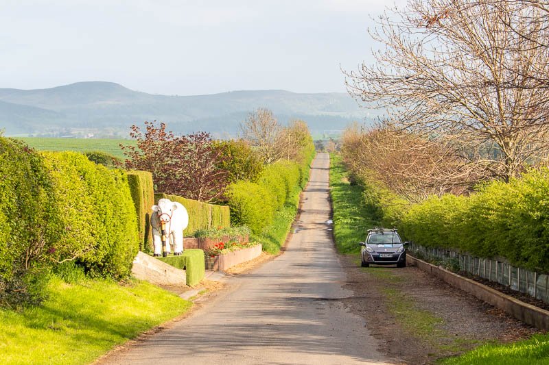
Generally, the lanes around East Horton are narrow and unsuitable for parking but there’s a lay-by of sorts on the eastern side of the village, opposite a magnificent, life-size (or possibly bigger) model of a white bull which stands in front of an otherwise unremarkable private house. Why, I know not but we observed the elderly owner gingerly removing bunting with which, no doubt, it had been decorated for the coronation of King Charles that had taken place the previous day.
The long-distance walking trail known as St Cuthbert’s Way also passes through the village and it was on this we began our trek westwards, enjoying long views towards the Chillingham Hills, the River Till and the rather lovely Weetwood Bridge over which we’d arrived. Although there’s a stone indicating a later date, the bridge may have been built some time in the c17th replacing the one used by the English army en-route to meet the Scots at Flodden in September 1513 (it’s one of the sites included on the Flodden1513 Eco-Museum trail).
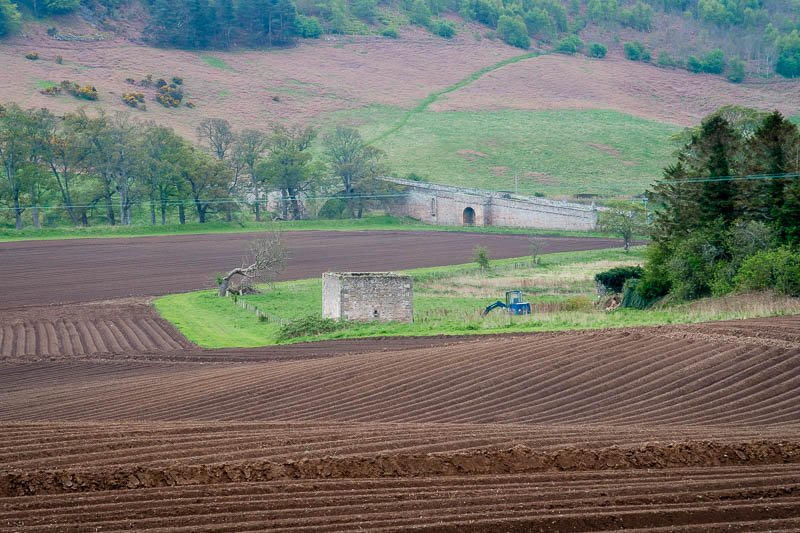
Much remodelled, Weetwood Hall started life – possibly as early as the c13th – in a defensive capacity when the bridge would undoubtedly have been of simpler construction. The oddly cubic structure in the field near the hall – listed as having a pyramidal roof of which there is now no evidence – is actually a dovecote.
Back on the trail, we left the road after a kilometre or so, turning right, onto a track to begin a long trudge uphill onto the moor towards, and past, a distinctive pillbox on the hillside at West Plantation. This is one of many WWII defences between Wooler and the coast intended to delay German egress from potentially excellent beach landing sites on the coast only a few miles away.
Our first stop was on the southern flank of Doddington Moor, shortly afterwards, where the map identified ‘cup and ring markings’ (which I’ll refer to simply as ‘C&R’ henceforth). We eventually found a small outcrop on which I identified a small but deep bowl-like depression set inside what looked like a partial outer ring (the post’s featured image above). It may have been weathering – it certainly wasn’t the regular annular sequences I was expecting to find – but after subsequent research, it seems that it may have been a form of oil burner used possibly for votive purposes.
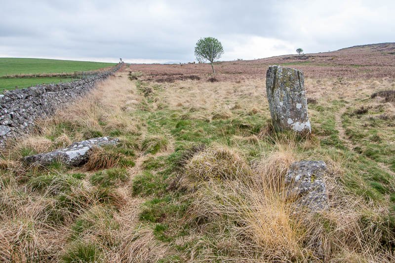
Next, we continued along the trail onto the broad shoulder of the moor, to a well-documented stone circle that has been suggested as dating to the Bronze Age. Surprisingly to me at least, descriptions vary because, despite the weight of the stones involved, it seems that they continue to move around. Today, the site consists of a single standing stone with three others lying horizontally, forming a small rectangle with a distinct, grave-sized, depression in the middle (not that I’m implying that it IS a grave; I know they were big on burial cists at that time).
We decided to strike out for the craggy, scarp slopes of the moor, overlooking Wooler, the Cheviots and the low-lying Milfield Plain, once a great lake inundated by the meltwaters of retreating glaciers. The bedrock of the moor is part of the Fell Sandstone Formation, an intermittent ridge that sweeps in an arc from the north-east to the south-west across central Northumberland. It creates many of the topographically and historically interesting upland areas on the south-eastern fringe of the Cheviots. To the south-west is the town of Wooler with the volcanic Cheviot behind (at 815 m, the highest hill in the Cheviot range). To the west is the valley of the River Glen guarded by the towering dome of Yeavering Bell (home to another glut of prehistoric sites) at the foot of which lies the site of the c7th Anglo-Saxon royal palace of Gefrin.

Several medieval battle sites involving the forces of England and Scotland can also be seen or inferred all, of which, sadly for the Scots, appear to have been English victories: Humbledon (or Homildon) Hill (1402) where the victor, Sir Henry Percy – Shakespeare’s ‘Hotspur’ – would be slain the following year at Shrewsbury after rebelling against Henry IV; Yeavering (1415) and Flodden (1513). In the c16th, the entire area – within what was known then as the English East March – was a vulnerable, bountiful target for Scottish reivers – from small bands to small armies often responding in kind to English raides. It was for this reason that fortified dwellings such as Doddington bastle (see below) existed on both sides of the border.
We continued to make our way along the crags towards the ‘Shepherd’s House’ and West Dod Law hillfort. This defensive site dates to the Iron Age (around 700 BCE) with occupation possibly extending into the Roman period that lasted until the c5th CE. Linked, no doubt, to the ability to work iron into weapons, the Iron Age seems to have been a period in which it became a priority for communities to defend themselves. Forts consist typically of habitation in the form of ‘hut circles’ within one or more circular earthworks (ditches) along which there may have been stone walls or timber palisades. Some have annexes or enclosures attached – like West Dod Law – though I’m not sure how many have a golf course! We located another C&R mark on the northern edge of the fort.

If you wander up to the nearby trig point on Dod Law itself (and why wouldn’t you?) you’ll pass through the site of what’s listed variously as a hillfort, a settlement or an enclosure at East Dod Law. It’s less well defined than West Dod Law but better than another one located to the east of the trig point which we found difficult to discern.
After wandering around for a good half-hour trying to locate, in the words of Clive Waddington, “a magnificent carved outcrop” (in addition to a 1:50,000 OS map I’d brought along his archaeological pocket guide titled ‘Maelmin’, published by English Heritage) we gave up and began our descent to Doddington. There’s another C&R site to visit on the way down which, because we were walking in the opposite direction to the guide book, took a bit of time to find but which I’ve marked as accurately as I can on the route.
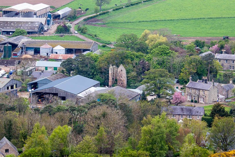
The descent also offers the best view of Doddington bastle which stands within Doddington South Farm – in the middle of the village. Binoculars will be handy or, as in my case, a 250 mm zoom lens. Little can be seen of it in the village itself apart from the top of its well preserved, steeply pitched but roofless gable, just peeking above the lawn of the farmhouse. The view through the trees from around the back is not much better and will depend on the season with winter being best.
Although its referred to as a bastle it’s more of a tower (or a strong house at least). Bastles are a bit less grand, being found mainly in Northern England, and almost exclusively in Northumberland and Cumbria. Those dating to the c16th (Doddington’s was constructed in 1584) were built primarily as protection from the Scottish reivers referred to previously though in some parts of the county they might just as likely be neighbours from the same side of the border.
With little more to be seen of the bastle we set off – amidst the cawing clamour from the rooks in the tall trees above the village – to inspect the church of St Mary & St Michael – just as it started to rain. As churches go this one has a lot to offer apart from much appreciated shelter from what amounted to no more than a brief shower (it’s so nice that churches are opening their doors again, although some seem to be more reluctant than others).

Dating to the c11th – quite early for your average medieval church – its chancel is unusually on the western end. There’s also a modest but imposing font with an early-c18th bowl set on a Norman pedestal but the most charismatic internal feature for me is the c13th gothic arcade which separates the north aisle, the front pews of which are almost invisible from the pulpit. Outside, in the tranquil churchyard, which has won richly deserved environmental awards, is a ‘watch-house’, built in 1826 to warn off grave-robbers!
We left the village by the same route we entered, past an impressive stone cross positioned over a well known now as the Dod Cross Well. I was surprised to read elsewhere that the cross, which is bare of any inscription or interpretation, is of no great age or significance, being instituted, for no particular purpose as far as I’m aware, by the Earl of Tankerville in 1846. Presumably this was the 6th earl who lived between 1810-1899 and whose descendants lived at Chillingham Castle until 1980.
Instead of turning back onto the moor we continued uphill on the lane as far as Wooler golf course (the only potential hospitality outlet on this route and one that welcomes walkers but which, sadly for us, was closed). Here I realised I’d made a navigational error: it appears that we should have gone through the gate that blocked the road ahead of us then turned right, following a track towards Doddington Quarry instead of continuing sharply uphill to the golf course.

From the photos on the route, you can see our approach towards the hillfort known as ‘The Ringses’ (I can’t get Tolkien’s Gollum out of my head whenever I see the name) from the top of the quarry while the trail as we should have taken it approaches from the bottom. It mattered little however and it wasn’t long before we were climbing the steep scarp slope to the fort which is described as ‘multivallate’ meaning that it has multiple ditches. You can certainly see the similarities with West Dod Law – I wonder if the neighbours got along?
The map showed that there was at least one more C&R site close to the trail between The Ringses and the Devil’s Causeway which, apart from offering a bit more exercise, was effectively the end of the walk. This would have been our next objective if we hadn’t missed the trail after crossing the first couple of fields. My excuse is that the 1:50,000 OS map isn’t sufficiently detailed for navigating over agricultural land. Missing are the field boundaries which, when way-marks are absent (or missed), makes it difficult to estimate where the trail goes. Long story short, we ended up floundering around off the trail.
It was easy enough to see where we needed to be but less straightforward to get there. After following a vague trail through a coniferous wood and skirting a couple of large arable fields we thankfully emerged onto the Devil’s Causeway – never was there a lane more aptly named. We were a bit closer to East Horton than originally intended but spared the ignominy of having to deal with an irate farmer. Finally we could relax and enjoy that leisurely stroll we’d promised ourselves, in the warm, evening sunshine with only the birds and some inquisitive cattle for company – a perfect finale.