Teesdale Way Section 11 (Middleton One Row to Yarm)
Introduction
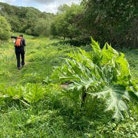
Section 11 of the Teesdale Way links the County Durham village of Middleton One Row to the North Yorkshire market town of Yarm while the trail itself stays entirely in County Durham. Despite a relatively flat profile – mainly through fields and some riparian woodland – this section of the Teesdale Way is fairly challenging. Depending on the season, the wooded section after Newsham Bank can be muddy, rugged, overgrown and poorly defined in places. Giant Hogweed – with its potential to cause severe skin irritation – proliferates in places along the trail making full leg cover and a stick or walking pole advisable.
Stats at a Glance
Distance 11.7 km/7.3 miles | Height Gain 41 m/135 ft | Maximum Elevation 31 m/101 ft (Middleton One Row) | Going Generally good, muddy in places. Sheltered on trails, tracks and road through farmland and woodlands. The trail is indistinct out of the wood after Newsham | Navigation (OS Maps Explorer 304; Landranger 93); GPS File | Hospitality & Supplies Middleton One Row (Ho); Yarm (All) | Start Water fountain, The Front, Middleton One Row NZ 352122 (w3w: hiking.cheering.revamped) | Finish Blue Bell Public House, Yarm NZ 418132 (w3w: bolsters.rare.army) | Grade Moderate | GALLERY
Trail Updates
The following updates have been published by The Durham Cow for this section: 250525
Description
Heading east from the water fountain on The Front, Middleton One Row, the route bears right, at the end of the village green, onto a trail behind a row of houses to descend to a narrow stretch of riparian woodland on the banks of the Tees. Before leaving Middleton One Row it’s worth remembering that nearby Middleton St George was the location of a WWII bomber station used mainly by the Royal Canadian Air Force and which today is Teesside International Airport – less than a kilometre away. Also on the edge of the airfield, is the c13th church dedicated to St George, the churchyard of which contains headstones of WWII aircrew.
When woodland gives way to broad, arable fields, you’ll soon notice – away in the distance – an unusual, red-roofed building which, by the time you turn off the riverside at Low Middleton, has fully resolved itself as a c19th, octagonal dovecote. Across the river at Low Middleton is Low Moor Gauging Station – the lowest station on the River Tees – where river levels have been recorded since 1969. Before the Tees Barrage was completed in 1995 the tidal limit was a couple of kilometres downstream at High Worsall.
You leave the river briefly at Low Middleton, to cross a spur on the river terrace (Fatten Hill) – the only significant ascent of the day. Further on, beyond Newsham Grange, the trail returns to the river via Newsham Bank which offers what is probably the finest view of the North York Moors anywhere on the trail. At the top of the slope, you’ll find one of a series of sculptures installed relatively recently while further to the left, a short distance off the trail, is the deserted medieval village (DMV) of Newsham, now identifiable only as a series of low mounds and earthworks.
The approaching 1.5 km stretch of riverside woodland can be quite challenging depending on seasonal conditions. The rugged trail is frequently overgrown with nettles and encroached upon by Giant Hogweed. It can be muddy, is boggy in patches, and there are usually some fallen trees to contend with. Out of the wood, the trail makes a wide sweep of the floodplain around the field edges. Whether it’s the approved route is difficult to say as the way-marked infrastructure (gates and stiles) is overgrown and dilapidated making. The state of the trail makes this section something of an outlier compared to the rest of the Teesdale Way.
Approaching the village of Aislaby which translates as ‘Aislac’s Farm’ – one of only a few Norse place names to be found on the north side of the river – the trail passes through more woodland where this time you’ll find long tracts of duck-boarding most of which is in good condition. The remaining distance to Yarm is straightforward, past the distinctive tower of St Mary Magdalene Church and the seemingly endless span of Yarm Railway Viaduct’s 43 arches to the road at the northern end of Yarm Bridge and The Blue Bell pub directly opposite.

