
Teesdale Way Section 7 (Whorlton to Gainford)
Introduction
Section 7 of the Teesdale Way links Whorlton Bridge, just south of the charming but somewhat spartan (in terms of amenities) village of Whorlton to the medieval village of Gainford which despite its burgeoning growth is hardly much better supplied – both are in County Durham. The trail sticks fairly close to the Tees for much of the journey with undulations, vegetation encroachment and rugged nature in places earning it a “moderate” grade. Irregular medieval field systems synonymous with the middle dale are substituted for large, arable fields interspersed with riparian woodland. With the exception of a pub, off the trail in Winston, and at the finish in Gainford, there are no hospitality options on this section.
Stats at a Glance
Distance 9.2 km/5.7 miles | Height Gain 137 m/450 ft | Maximum Elevation 133 m/436 ft (Low Barn) | Going Generally good though muddy in places. Sheltered on trails, tracks and road through woodlands and farmland | Navigation (OS Maps Explorer 304; Landranger 92); GPS File |Hospitality & Supplies Gainford (BB; PH; GS; FF); Winston (PH) [0.5 km] | Start Whorlton Bridge, Whorlton NZ 106145 (w3w: marine.jaws.technical) | Finish Village Cross, Gainford NZ 170168 (w3w: fanfare.effort.puddings) | Grade Moderate | GALLERY
Trail Updates
The following updates have been published by The Durham Cow for this section: 060625
Description
From the toll house at the end of Whorlton Bridge, the route starts uphill on the road before entering woods at the hairpin bend. Using steps it descends to Whorlton Beck which it crosses via stepping stones then continues over slippery limestone, past the former site of Whorlton Lido (across the river where only the Thorpe Light Railway remains) to reach the ruined cottage that – in days before the bridge – was home to a ferry-man.
Opposite Waterside Cottages the limestone forms a broad pavement right down to the edge of the river. It’s a lovely spot from where the trail departs, past a life preserver station, and steeply uphill through the wood to reach the escarpment above. From here to Winston, the trail around the edges of multiple arable fields is often encroached upon by vegetation. In one place, approaching Graft’s Farm it’s slipping slowly away but remains passable. There are good views of Wycliffe Hall on the south side of the river and Stubb House to the north.
Eventually, after passing through a small park of holiday cabins and the following wood, you’ll get a glimpse of the distinctive spire of St Andrew’s Church in Winston. You reach the road at the northern end of Winston Bridge aka “Spitfire Bridge” (there’s a small, metal sculpture of a Spitfire fixed into the parapet on the southern end recalling the time in 1988 when a Spitfire was flown under the bridge during the making of a TV series).
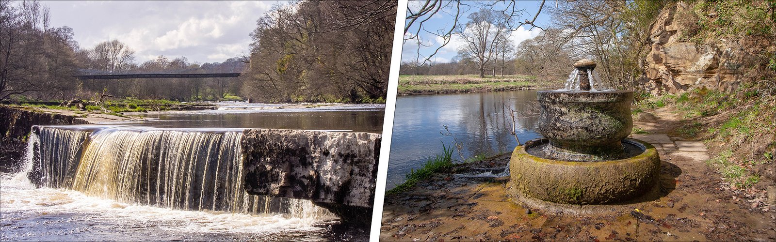
The trail crosses the road at the northern end where there’s a short but steep hump, on the outskirts of Winston, to get up and over before descending gently through quiet, riparian woodland to West Tees Railway Bridge. A short section on the embankment of a former railway delivers you directly onto the busy A67 where initially there’s a grass verge but no footpath. You’ll pass a couple of “Marking the Parish Boundaries” sculptures before descending to the Tees to visit Gainford’s ornamental sulphurous spring.
Visible from the roadside – as you approach the village – is Gainford Hall identifiable by its distinguished, post-medieval stonework. Recently restored, this outstanding example of Jacobean architecture was built for the clergyman John Cradock some time around 1603. Way beyond the hall, across the river, is another eye-catching structure, a medieval dovecote which stands in front of the ruined Chapel of St Lawrence. The chapel once served the deserted medieval village of Old Richmond.
The route makes its way towards the centre of the medieval part of Gainford via Low Row. After passing the gates of Gainford Hall where the view, unfortunately, is obscured by vegetation, you’ll soon see the stone cross – installed in 1897 to commemorate Queen Victoria’s diamond jubilee – which marks the end of Section 7 of the Teesdale Way. If you’re looking for refreshments you’ll find The Cross Keys pub not far away. It’s open from lunch time on a weekend but week-day opening varies quite a bit, so check first.