On the day the clocks went forward, with spring very much in the air, we decided to drive over to Teesdale to visit High Force, England’s largest waterfall. Primarily, it was in the hope of photographing the Tees spilling into the secondary, northern, falls – an event that has so far eluded me. Other than a few lengthy bouts of rain in the previous week there was no particular reason to expect it happen but I’ve never needed an excuse to visit one of Teesdale’s most iconic spots.
You can watch the video we made to accompany this walk HERE.
Stats at a Glance
Distance 8.2 km/5.1 miles | Height Gain 75 m/246 ft | Max Elevation 325 m/1066 ft | Going Good, on well-constructed footpaths and trails, rugged and muddy in places. Long, steep ascents/descents via steps. Reasonably sheltered | Hospitality Bowlees Visitor Centre (Ca; WC); High Force Hotel (PH; WC; Re; Rf) | Start & Finish Bowlees Visitor Centre | Grade Moderate
The plan was to park the car at Bowlees Visitor Centre and follow the High Force Geotrail to the falls. This is a relatively new take on what has long been a classic Teesdale ramble mostly on land belonging either to the Strathmore Estate, south of the Tees, or Lord Barnard’s Raby Estate on the north. Generally we’d be using well consolidated paths including the Pennine Way (also Teesdale Way at this point) which links all of the bridges on the Strathmore side.
Bowlees Visitor Centre
The visitor centre at Bowlees is the hub for the North Pennines Area of Outstanding Beauty (AONB) Geopark an area that incorporates much of Upper Teesdale and neighbouring Weardale. As well as a cafe, art gallery, book & gift shop, it offers ecology programs and a great deal of casual information about the park and its environment. The car park, which is not far away and from where you can also visit two other popular attractions – Gibson’s Cave and Summerhill Force – operates on discretionary donations rather than a fixed parking charge.
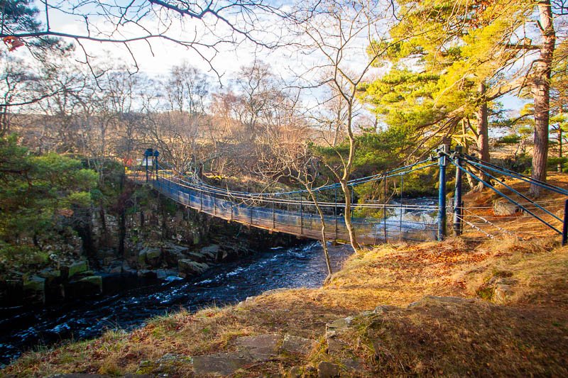
Low Force & Wynch Bridge
After passing through the tiny hamlet of Bowlees we’d cross the B6277 which runs all the way through the dale, then over a couple of fields, to reach Low Force, a picturesque and popular picnic spot where the River Tees tumbles over the Whin Sill in a series of low falls. Suspended somewhat precariously over a rocky gorge is Wynch Bridge, the pivotal point on today’s route and probably the most charismatic bridge on the Tees, guaranteed to bring out the child in anyone. Although the Pennine Way footpath from Wynch Bridge is generally well constructed there are still a few areas that remain quite rugged. Nevertheless, it’s a relatively easy walk to Holwick Head after which, having recrossed the Tees, there’s a steep climb via steps back to the road and High Force Hotel.
Wynch Bridge and the River Tees at Low Force
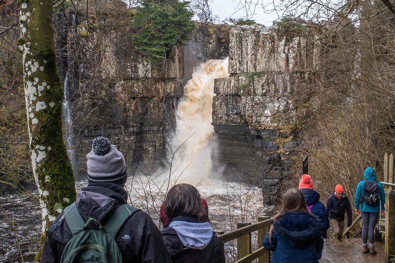
High Force Hotel and the ‘Woodland Walk’ to High Force
The route from the hotel to the foot of the falls is on private land owned and administered by the Raby Estate (as is the hotel itself). At the time of writing a visit to the falls costs £2.50 per person, payable at the kiosk outside the hotel. For that you get a gentle walk on a well constructed path with information points to help you identify the maturing deciduous tree species planted to replace those lost in a severe storm in 1992. You can return the way you came or continue through the magical waterfall woods, a short, pleasant but fairly strenuous circuit inhabited by mysteriously impassive, carved woodland creatures.
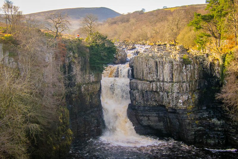
Across the river – on the Strathmore side – the Pennine Way provides the classic, spectacular panorama from the top of the falls absolutely free of charge but the private route on the Raby side is the only way of seeing them from the bottom and is well worth the admission. The popular and welcoming hotel not only advertises itself as ‘dog friendly’ but as specialising in ‘waterfall weddings’. Having tied the knot a long time ago we felt able to ignore that particular USP but contented ourselves with ordering soup and a drink in the busy bar (refreshments are also available at the ticket kiosk).
The public view of the River Tees at High Force from the Pennine Way
Route Alternatives
It’s possible to return to Bowlees on the north side of the river by continuing on the High Force Geotrail (which we’ll do some day) but today we decided to stick with the river, retracing our steps as far as Wynch Bridge and continuing on the Pennine Way to Scorberry Bridge where there are some nice examples of Carboniferous fossils in the Cockleshell Limestone flats on the other side of the river near the foot of the bridge. The section also takes in Staple Crag, Wynch Mine and Scorberry Mine, all of which help to illustrate Teesdale’s fascinating geology.
More Geology & History
The general direction of the River Tees runs roughly parallel with a major geological feature known as the Teesdale Fault which has, more or less, created the walk as it’s experienced today. The bedrock along the river has been ‘downthrown’ by tens of metres creating Keedholm Scar and High Force itself, and allowing the Tees to continue over the Whin Sill even though it appears to fall past it at High Force.
The name ‘Whin Sill’ was given by quarrymen to volcanic rock that was forced – as molten magma – into joints in the Carboniferous sedimentary bedrock. This happened millions of years after the bedrock itself had been laid down as a series of cyclothems (repeating sequences of sediment – sandstone, siltstone, limestone etc – deposited by fluctuating sea levels) within a huge part of the North Pennines known as the Alston Formation. The best place to see this layering is at High Force itself where it’s easy to identify the relatively hard Whin Sill sitting on top of bands of softer, sedimentary sandstone and limestone associated with the Tyne Bottom cyclothem.
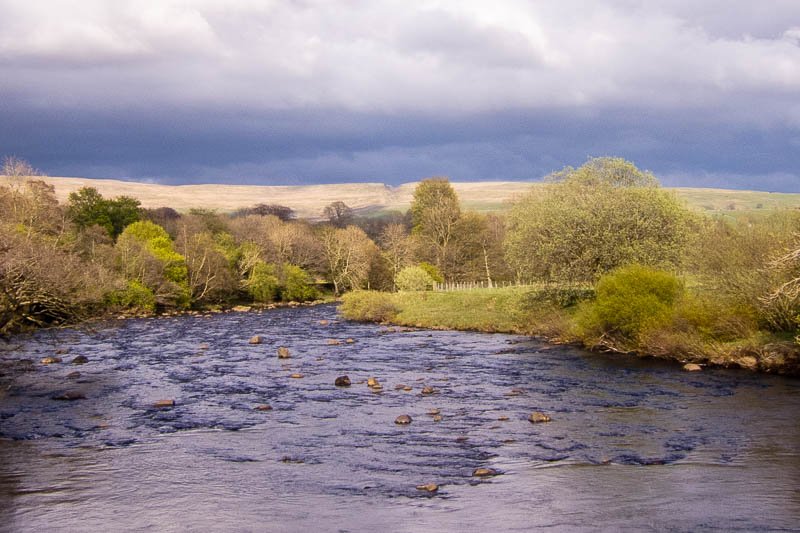
Coldberry Gutter from the River Tees downstream of Holwick Head Bridge
On the way back, downstream from Holwick Head Bridge, you should be able to identify a distinctive notch in the hills of the eastern skyline. This is Coldberry Gutter, one of a series of glacial meltwater channels created thousands rather than millions of years ago. Teesdale is as well known for its glacial features such as Coldberry as it is for its igneous geology such as the Whin Sill and the Cleveland-Armathwaite Dyke – even younger than the Whin Sill and which is exposed in Coldberry Gutter. It’s the igneous activity however, that has had the most profound effect on County Durham’s dales helping to form rich deposits of commercially valuable ores and minerals.
Mining for these minerals stretches back many centuries to pre-Roman times, particularly with regard to ironstone and lead. Around Coldberry Gutter lead ore (galena), was sought using primitive hushing methods (large volumes of water were used to sluice away loosened mining debris) identifiable as the channels of Red Grooves Hushes on the slope below the gutter. More mining remnants in the form of adits (tunnels) and spoil heaps can be seen alongside the trail downstream of Wynch Bridge at the sites of Wynch and Scorberry mines, active briefly in the c20th. Archaeological finds have been made all along the dale indicating that the area has been inhabited and/or worked since Neolithic times (4000 BCE-2200 BCE), through the Iron-Age and Roman periods, and with much evidence of medieval land use around Holwick including a deserted medieval village (DMV).
This website uses cookies to improve your experience. We'll assume you're ok with this, but you can opt-out if you wish.AcceptRead More
Privacy & Cookies Policy
Privacy Overview
This website uses cookies to improve your experience while you navigate through the website. Out of these, the cookies that are categorized as necessary are stored on your browser as they are essential for the working of basic functionalities of the website. We also use third-party cookies that help us analyze and understand how you use this website. These cookies will be stored in your browser only with your consent. You also have the option to opt-out of these cookies. But opting out of some of these cookies may affect your browsing experience.
Necessary cookies are absolutely essential for the website to function properly. This category only includes cookies that ensures basic functionalities and security features of the website. These cookies do not store any personal information.
Any cookies that may not be particularly necessary for the website to function and is used specifically to collect user personal data via analytics, ads, other embedded contents are termed as non-necessary cookies. It is mandatory to procure user consent prior to running these cookies on your website.